Center Township, Union County, Indiana
Center Township is one of six townships in Union County, Indiana, United States. As of the 2010 census, its population was 3,048 and it contained 1,330 housing units.[2]
Center Township | |
|---|---|
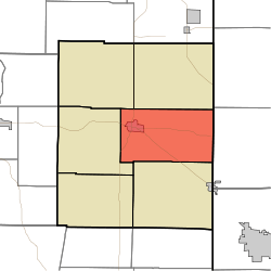 Location in Union County | |
| Coordinates: 39°37′40″N 84°53′01″W | |
| Country | United States |
| State | Indiana |
| County | Union |
| Government | |
| • Type | Indiana township |
| Area | |
| • Total | 28 sq mi (70 km2) |
| • Land | 27.92 sq mi (72.3 km2) |
| • Water | 0.08 sq mi (0.2 km2) 0.29% |
| Elevation | 1,053 ft (321 m) |
| Population (2010) | |
| • Total | 3,048 |
| • Density | 109.1/sq mi (42.1/km2) |
| Time zone | UTC-5 (Eastern (EST)) |
| • Summer (DST) | UTC-4 (EDT) |
| ZIP code | 47353 |
| Area code(s) | 765 |
| GNIS feature ID | 453194 |
Geography
According to the 2010 census, the township has a total area of 28 square miles (73 km2), of which 27.92 square miles (72.3 km2) (or 99.71%) is land and 0.08 square miles (0.21 km2) (or 0.29%) is water.[2]
Cities and towns
- Liberty (the county seat)
Unincorporated towns
- Cottage Grove at 39.5964394°N 84.8616243°W
- Goodwins Corner at 39.6492170°N 84.8335686°W
- Lotus at 39.6131056°N 84.8899586°W
- Salem at 39.5964391°N 84.8902362°W
(This list is based on USGS data and may include former settlements.)
Cemeteries
The township contains these five cemeteries: Calvary, Drook, Pentecost, Sering and West Point.
Airports and landing strips
- E-Z Acres Airport
Landmarks
- Whitewater Memorial State Park (east edge)
School districts
- Union County-College Corner Joint School District
Political districts
- Indiana's 6th congressional district
- State House District 55
- State Senate District 43
gollark: There are political axes and compasses and hypercubes and such, and while none (well, except ridiculous ones) can actually capture your political views entirely accurately, some are *useful*.
gollark: China didn't exactly *help* things by covering it up initially, but America was/is definitely not doing great either.
gollark: The UK is at least taking it somewhat seriously, if not actually handling it that well.
gollark: North Korea is probably just doing a combination of not testing, reporting no accurate data whatsoever, and killing anyone with bad symptoms.
gollark: If you have drew a line-art version of this it would probably be possible to write a script to convert it to equations automatically.
References
- United States Census Bureau 2007 TIGER/Line Shapefiles
- United States Board on Geographic Names (GNIS)
- IndianaMap
- "US Board on Geographic Names". United States Geological Survey. October 25, 2007. Retrieved 2017-05-09.
- "Population, Housing Units, Area, and Density: 2010 - County -- County Subdivision and Place -- 2010 Census Summary File 1". United States Census. Archived from the original on 2020-02-12. Retrieved 2013-05-10.
External links
Places adjacent to Center Township, Union County, Indiana | |
|---|---|
Municipalities and communities of Union County, Indiana, United States | ||
|---|---|---|
| Towns | Map of Indiana highlighting Union County | |
| Townships | ||
| Unincorporated communities | ||
This article is issued from Wikipedia. The text is licensed under Creative Commons - Attribution - Sharealike. Additional terms may apply for the media files.