Harewood, Herefordshire
Harewood is a civil parish in Herefordshire, England. It is approximately 7 miles (11 km) south from the city and county town of Hereford and 4 miles (6 km) north-west from the market town of Ross-on-Wye. Within Harewood is the rural estate of Harewood Park, owned by the Duchy of Cornwall. The parish is part of the Wye Valley Area of Outstanding Natural Beauty.
| Harewood | |
|---|---|
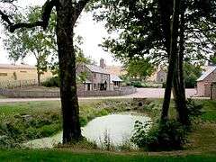
 Home Farm, Harewood Park | |
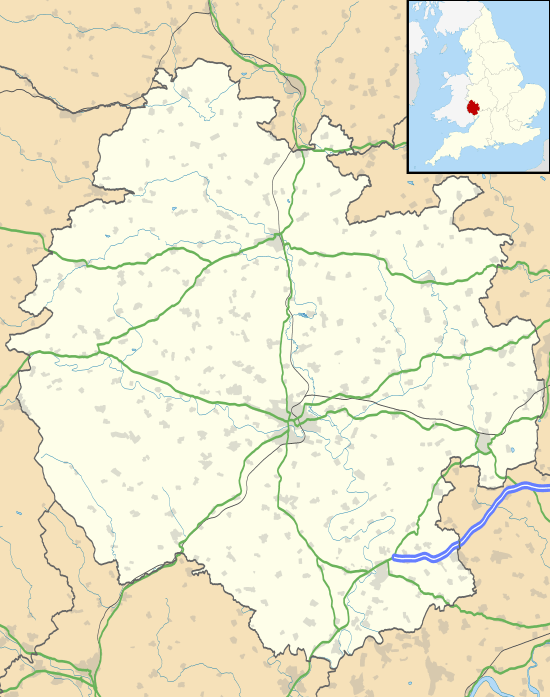
 Harewood Location within Herefordshire | |
| OS grid reference | SO531282 |
| • London | 115 mi (185 km) ESE |
| Unitary authority | |
| Ceremonial county | |
| Region | |
| Country | England |
| Sovereign state | United Kingdom |
| Post town | Hereford |
| Postcode district | HR2 |
| Police | West Mercia |
| Fire | Hereford and Worcester |
| Ambulance | West Midlands |
| UK Parliament | |
Harewood is represented by one councillor on the ten-member Llanwarne & District Group Parish Council[1] The parish is linked by bus at Harewood End to Hereford and Gloucester, with services provided by Stagecoach West.[2] The closest National Rail station is at Hereford on the Welsh Marches Line, 6 miles (10 km) to the north.[3]
Geography
The parish borders the parishes of Hentland at the east, Pencoyd at the south-west, Llanwarne and Llandinabo at the north-west, and Little Birch at the north. It includes the hamlet of Harewood End at the extreme south and on the A49 road, which forms the border with Pencoyd, and runs locally from Hereford at the north to Ross-on-Wye at the south-east. The closest village is Hoarwithy in Hentland, bordering at the extreme north-east of the parish.[3][4][5][6]
Harewood is approximately 2 miles (3 km) from north to south, and 1.5 miles (2.4 km) at its widest from the north-west to south-east. It is entirely rural, of farms, fields, woods, isolated ponds, and dispersed properties. A stream rising at the north-west of the parish, flows east to the Wriggle Brook, a tributary of the River Wye in Hentland. Within the parish are four farms: Home Farm,[7] Grange Farm, Woodlands Farm and Redbrook Farm. Apart from the A49, all routes are footpaths, bridleways and farm tracks.[4][3][5][6]
Landmarks
Harewood is entirely within the north-west of the Wye Valley Area of Outstanding Natural Beauty (AONB).[8] The principal landmark of the parish is the rural estate of Harewood Park, owned by the Duchy of Cornwall. Its house, demolished in 1959, was an 1839 rebuild by Sir Hungerford Hoskyns, 7th Baronet (1776–1862), on the site of the previous Tudor house.[9][10][11] The Park includes the seven Grade II listed buildings of the parish, including the former parish church of St Denis, rebuilt in 1864 but today a store, and Grange Farmhouse possibly dating to the 17th century. Listed at the west of the church is the pedestal tomb 'Hoskyns Monument' and a former late 18th-century stable block which at the time of the 1987 listing was a dog-breeding station. At the south-west of the farmhouse are a late 18th-century cowhouse, an 18th-century granary, and a late 18th-century barn.[12][13][14][15][16][17][18]
References
- Llanwarne & District Group Parish Council web site. Retrieved 22 February 2020
- "Harewood End Inn", Bustimes.org. Retrieved 22 February 2020
- Harewood, Herefordshire, UK Grid Reference Finder Retrieved 23 February 2020
- Extracted from "Harewood, Herefordshire", GetOutside, Ordnance Survey. Retrieved 22 February 2019
- Harewood, Herefordshire, OpenStreetMap Retrieved 22 February 2020
- Harewood, Herefordshire, Google Maps. Retrieved 22 February 2020
- Home Farm, Harewood Park, Google Street View (image date October 2011). Retrieved 22 February 2020
- Wye Valley AONB Map", Wyevalleyaonb.org.uk. Retrieved 22 February 2020
- "Lost Heritage: Harewood Park". Archived from the original on 22 February 2011. Retrieved 22 February 2020.
- "Harewood Park", Parks & Gardens. Retrieved 22 February 2020
- "Harewood Park", Lost Heritage. Retrieved 22 February 2020
- Historic England. "Former Church of St Denis at the Kennels, Harewood Park (1288620)". National Heritage List for England. Retrieved 22 February 2020.
- Historic England. "Grange Farmhouse (1214407)". National Heritage List for England. Retrieved 22 February 2020.
- Historic England. "Hoskyns Monument About 3 Yards South West of South West Corner of the Former Church of St Denis at the Kennels, Harewood Park (1214393)". National Heritage List for England. Retrieved 22 February 2020.
- Historic England. "Former Stable Block About 20 Yards West of the Former Church of St Denis at the Kennels, Harewood Park (1288740)". National Heritage List for England. Retrieved 22 February 2020.
- Historic England. "Cowhouse and Granary About 50 Yards South West of Grange Farmhouse (1214409)". National Heritage List for England. Retrieved 22 February 2020.
- Historic England. "Granary About 25 Yards South South West of Grange Farmhouse (1214410)". National Heritage List for England. Retrieved 22 February 2020.
- Historic England. "Barn About 90 Yards South West of Grange Farmhouse (1214408)". National Heritage List for England. Retrieved 22 February 2020.
External Links

- Harewood, Genuki