Hanotiya
Hanotiya is a Town or Panchayat of Chhindwara district in the Indian state of Madhya Pradesh, India. It is located at 48km in East from District headquarter.
Hanotiya हनोतिया | |
|---|---|
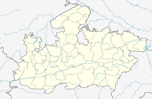
 Hanotiya Location in Madhya Pradesh, India  Hanotiya Hanotiya (India) | |
| Coordinates: 22.1485064°N 78.5695936°E | |
| County | |
| State | Madhya Pradesh |
| District | Chhindwara |
| Government | |
| • Type | Village Council |
| • Body | Hanotiya Village Panchayat |
| • Sarpanch | Pritam Dhurvey |
| Population (2011) | |
| • Total | 1,350 |
| Languages | |
| • Official | Hindi and English |
| • Regional | Hindi, English and Marathi |
| Time zone | UTC+5:30 (IST) |
| Postal Code | 480551 |
| Telephone Code | 07160 |
| ISO 3166 code | IN-MP |
| Vehicle registration | MP-28 |
07:41, 18 July 2020 (UTC)Yogesh Pahade
Demographics
According to the 2011 census Hanotiya Village has a population of 1350.
Geography
Hanotiya is located at 22.1496°N 78.5780°E.[3]
Attractions
- Hanotiya Madai Mela
- Raini Dham (7days fair)
See Also
gollark: Lol implicit typecasting stuff (JS).
gollark: Lol poor error handling.
gollark: For instance, lol no generics.
gollark: They are bad in VARIOUS ways.
gollark: On the one hand a few big companies apparently have ridiculously good tools not really available anywhere else, but on the other hand most places are going to be using things like JS and Go.
External Links
This article is issued from Wikipedia. The text is licensed under Creative Commons - Attribution - Sharealike. Additional terms may apply for the media files.