Hagarville, Arkansas
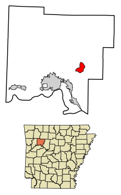
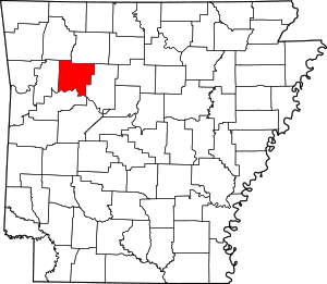
Hagarville is a census-designated place in Johnson County, Arkansas, United States. Its population was 129 as of the 2010 census.[2]
Hagarville, Arkansas | |
|---|---|
 Location of Hagarville in Johnson County, Arkansas | |
 Hagarville Location of Hagarville in Johnson County, Arkansas  Hagarville Hagarville (the United States) | |
| Coordinates: 35°30′56″N 93°19′30″W | |
| Country | United States |
| State | Arkansas |
| County | Johnson |
| Area | |
| • Total | 4.16 sq mi (10.78 km2) |
| • Land | 4.14 sq mi (10.72 km2) |
| • Water | 0.02 sq mi (0.05 km2) |
| Elevation | 531 ft (162 m) |
| Population | |
| • Total | 812 |
| • Estimate (2016)[3] | N/A |
| Time zone | UTC-6 (Central (CST)) |
| • Summer (DST) | UTC-5 (CDT) |
| Area code(s) | 479 |
| GNIS feature ID | 77102[4] |
Demographics
| Historical population | |||
|---|---|---|---|
| Census | Pop. | %± | |
| U.S. Decennial Census[5] | |||
gollark: Well, initially.
gollark: Yes. That is what I said.
gollark: It does NOT do that on my python interpretoid.
gollark: Fascinating!
gollark: You can probably also do `myOtherList[:]` depending on apioapiocryoforms.
References
- "2016 U.S. Gazetteer Files". United States Census Bureau. Retrieved Jul 18, 2017.
- "U.S. Census website". U.S. Census Bureau. Retrieved 3 May 2011.
- "Population and Housing Unit Estimates". Retrieved June 9, 2017.
- U.S. Geological Survey Geographic Names Information System: Hagarville, Arkansas
- "Census of Population and Housing". Census.gov. Retrieved June 4, 2016.
This article is issued from Wikipedia. The text is licensed under Creative Commons - Attribution - Sharealike. Additional terms may apply for the media files.
