Gyzyletrek
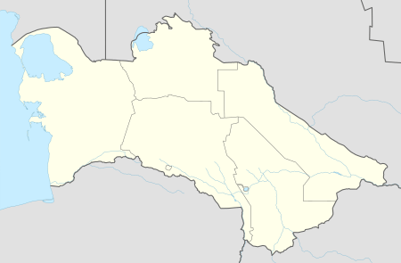
Gyzyletrek (Turkmen: Etrek, also Bayat-Khadzhi, Kyzyl-Atrek) is a town in western Turkmenistan. It is located in Balkan Province on the Atrek River bordering on Iran. The name means "Red Atrek" and may be a reference to the silt load that the Atrek River carries at that point. It is the capital of Etrek District (formerly Gyzyletrek District).
Gyzyletrek Bayat-Khadzhi | |
|---|---|
 Gyzyletrek Location in Turkmenistan | |
| Coordinates: 37°39′41″N 54°45′38″E | |
| Country | |
| Province | Balkan Province |
| Elevation | 29 m (95 ft) |
| Area code(s) | 242 |
Nearby towns and villages include Agach-Arvat (4.8 km), Torshakli, Iran (6.3 km), Yasydepe (15.6 km), and Yarymtyk (19.4 km). There is no air service to Gyzyletrek, although there is an airport, Kizyl Atrek Airport, just to the south.[1]
Climate
Gyzyletrek has a desert climate (Köppen climate classification BWk), with cool winters and hot summers. Rainfall is generally light and erratic, and is heavier in winter than in summer.
| Climate data for Gyzyletrek | |||||||||||||
|---|---|---|---|---|---|---|---|---|---|---|---|---|---|
| Month | Jan | Feb | Mar | Apr | May | Jun | Jul | Aug | Sep | Oct | Nov | Dec | Year |
| Average high °C (°F) | 11.2 (52.2) |
12.9 (55.2) |
16.8 (62.2) |
23.4 (74.1) |
29.6 (85.3) |
33.9 (93.0) |
35.6 (96.1) |
35.2 (95.4) |
32.0 (89.6) |
25.6 (78.1) |
19.4 (66.9) |
14.0 (57.2) |
24.1 (75.4) |
| Daily mean °C (°F) | 5.4 (41.7) |
6.5 (43.7) |
10.2 (50.4) |
16.2 (61.2) |
21.9 (71.4) |
26.2 (79.2) |
28.5 (83.3) |
28.3 (82.9) |
24.8 (76.6) |
18.0 (64.4) |
12.3 (54.1) |
7.7 (45.9) |
17.2 (62.9) |
| Average low °C (°F) | 1.0 (33.8) |
1.6 (34.9) |
5.3 (41.5) |
10.7 (51.3) |
15.5 (59.9) |
20.2 (68.4) |
23.0 (73.4) |
22.8 (73.0) |
18.8 (65.8) |
11.9 (53.4) |
6.8 (44.2) |
3.3 (37.9) |
11.7 (53.1) |
| Average precipitation mm (inches) | 23 (0.9) |
21 (0.8) |
33 (1.3) |
21 (0.8) |
18 (0.7) |
3 (0.1) |
4 (0.2) |
5 (0.2) |
8 (0.3) |
14 (0.6) |
21 (0.8) |
23 (0.9) |
194 (7.6) |
| Average precipitation days (≥ 0.1 mm) | 7 | 6 | 7 | 5 | 4 | 1 | 1 | 1 | 2 | 4 | 5 | 6 | 49 |
| Average relative humidity (%) | 76 | 73 | 71 | 66 | 60 | 56 | 60 | 61 | 60 | 60 | 70 | 77 | 66 |
| Source: NOAA (1961-1990)[2] | |||||||||||||
References
- "Kizyl Atrek Airport". OurAirports. Retrieved 9 February 2013.
- "Climate Normals for Gyzyletrek". National Oceanic and Atmospheric Administration. Retrieved 9 February 2013.
External links
- "Gyzyletrek" at geonames.org