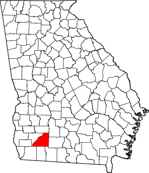
Greenwood, Georgia
Greenwood is an unincorporated community located in Mitchell County, Georgia, United States.[1]
Greenwood, Georgia Greenwood Community | |
|---|---|
| Country | United States |
| State | Georgia |
| County | Mitchell |
| Elevation | 151 ft (46 m) |
| Time zone | UTC-5 (Eastern (EST)) |
| • Summer (DST) | UTC-4 (EDT) |
| ZIP code | 31730 |
| Area code(s) | 229 |
History
Greenwood was laid out about 1880 and named for the live oak trees near the original town site.[2]
Geography
Greenwood sits on the intersection of Ga Highway 97 and Greenwood Road. Fox Run Road, Kurbo Lane, Pipeline Road, Sassafras Tea Road, Richards Lane, and Flats Road also rest in the area.[1]
Greenwood's latitude is at 31.198 and its longitude is at -84.34. Its elevation rests at 151 feet. Greenwood appears on the Branchville U.S. Geological Survey Map.[1]
Churches
The Greenwood Free Will Baptist Church sits in the area as well as the Anitoch Baptist Church.[1]
gollark: You could probably even make it work in a slightly less utterly accursed way using the privacy-preserving contact tracing mechanisms people came up with.
gollark: The correct libertarian solution is to implement a vast surveillance state capable of accurately telling who you were infected by if this happens, so that you can invoice/sue them.
gollark: The UK is highly "based" and apparently just removed all rabies (except in bats) ages ago.
gollark: Actually, heavy elements like uranium are more common in the inner planets.
gollark: It isn't. The actual number of cases is independent of how many you know about.
External links
- "Greenwood, Georgia GA Community". Georgia Hometown Locator. Retrieved 2011-05-17.
- Krakow, Kenneth K. (1975). Georgia Place-Names: Their History and Origins (PDF). Macon, GA: Winship Press. p. 98. ISBN 0-915430-00-2.
This article is issued from Wikipedia. The text is licensed under Creative Commons - Attribution - Sharealike. Additional terms may apply for the media files.
