Flint, Georgia
Flint is an unincorporated community located in Mitchell County, Georgia, United States.[1]
Flint, Georgia Flint Community | |
|---|---|
| Country | United States |
| State | Georgia |
| County | Mitchell |
| Elevation | 184 ft (56 m) |
| Time zone | UTC-5 (Eastern (EST)) |
| • Summer (DST) | UTC-4 (EDT) |
| ZIP code | 31716 |
| Area code(s) | 229 |
History
The community was named after the Flint River.[2] An early variant name was "Cochrans Mill".[3]
Geography
Flint's latitude is at 31.317 and its longitude is at -84.179. Its elevation rests at 184 feet. Flint appears on the Baconton South U.S. Geological Survey Map and lies at the intersection of U.S. 19 and Tution Road. Flint Road, River Road, and Saint Mary's Road also lie in the area.[1]
gollark: It's not the developers' fault that GMail is stupid.
gollark: Someone can sign up for an account using a differently dotted version of your email, and it'll seem like one which is actually directed to you.
gollark: Or, er, not-really-phishing.
gollark: Because phishing attacks.
gollark: It;s a really stupidisoiasufi feature.
References
- "Flint, Georgia GA Community". Georgia Hometown Locator. Retrieved 2011-05-12.
- Krakow, Kenneth K. (1975). Georgia Place-Names: Their History and Origins (PDF). Macon, GA: Winship Press. p. 79. ISBN 0-915430-00-2.
- U.S. Geological Survey Geographic Names Information System: Flint
Municipalities and communities of Mitchell County, Georgia, United States | ||
|---|---|---|
| Cities | 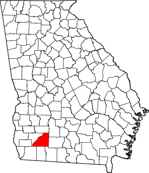 Map of Georgia highlighting Mitchell County | |
| Town | ||
| Unincorporated communities | ||
| Footnotes | ‡This populated place also has portions in an adjacent county or counties | |
| Authority control |
|---|
This article is issued from Wikipedia. The text is licensed under Creative Commons - Attribution - Sharealike. Additional terms may apply for the media files.