Grayhawk, Missouri
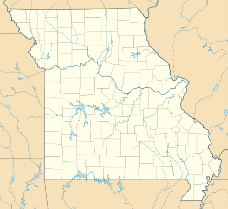
Grayhawk is an unincorporated community and census-designated place in Ste. Genevieve County, Missouri, United States. Its population was 525 as of the 2010 census.[1]
Grayhawk, Missouri | |
|---|---|
 Grayhawk, Missouri  Grayhawk, Missouri | |
| Coordinates: 37°55′52″N 90°14′20″W | |
| Country | United States |
| State | Missouri |
| County | Ste. Genevieve |
| Area | |
| • Total | 4.701 sq mi (12.18 km2) |
| • Land | 4.353 sq mi (11.27 km2) |
| • Water | 0.348 sq mi (0.90 km2) |
| Elevation | 692 ft (211 m) |
| Population | |
| • Total | 525 |
| • Density | 110/sq mi (43/km2) |
| Time zone | UTC-6 (Central (CST)) |
| • Summer (DST) | UTC-5 (CDT) |
| Area code(s) | 573 |
| GNIS feature ID | 2587075[2] |
Geography
According to the U.S. Census Bureau, the community has an area of 4.701 square miles (12.18 km2); 4.353 square miles (11.27 km2) of its area is land, and 0.348 square miles (0.90 km2) is water.[1]
gollark: If I remember right Go strings are just byte sequences with no guarantee of being valid UTF-8, but all the functions working on them just assume they are.
gollark: Oh, and the strings are terrible.
gollark: Also, channels are not a particularly good primitive for synchronization.
gollark: Also, the implicit interfaces are terrible.
gollark: - lacking in generics - you have to use `interface{}`- public/private visibility is controlled by *capitalization* of all things- weird bodgey specialcasing instead of good generalizable solutions- you literally cannot express a `max` function which returns the largest of two of any type of number in a well-typed way
References
- "2010 Census Gazetteer Files - Places: Missouri". U.S. Census Bureau. Retrieved January 19, 2017.
- "Grayhawk Census Designated Place". Geographic Names Information System. United States Geological Survey.
Municipalities and communities of Sainte Genevieve County, Missouri, United States | ||
|---|---|---|
| Cities | 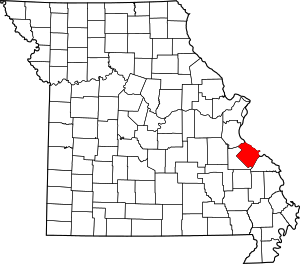 Map of Missouri highlighting Sainte Genevieve County | |
| Townships | ||
| CDPs | ||
| Other communities | ||
| Ghost towns | ||
This article is issued from Wikipedia. The text is licensed under Creative Commons - Attribution - Sharealike. Additional terms may apply for the media files.