Gold Hill Township, Gallatin County, Illinois
Gold Hill Township is one of ten townships in Gallatin County, Illinois, USA. As of the 2010 census, its population was 1,708 and it contained 811 housing units.[2]
Gold Hill Township | |
|---|---|
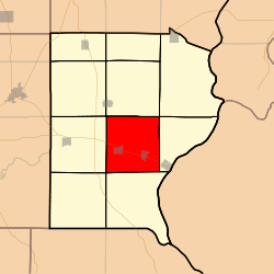 Location in Gallatin County | |
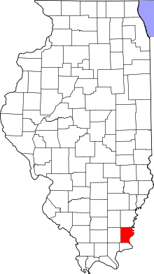 Gallatin County's location in Illinois | |
| Coordinates: 37°44′12″N 88°12′43″W | |
| Country | United States |
| State | Illinois |
| County | Gallatin |
| Established | November 5, 1890 |
| Area | |
| • Total | 35.26 sq mi (91.3 km2) |
| • Land | 34.93 sq mi (90.5 km2) |
| • Water | 0.33 sq mi (0.9 km2) 0.94% |
| Elevation | 351 ft (107 m) |
| Population (2010) | |
| • Estimate (2016)[1] | 1,596 |
| • Density | 48.9/sq mi (18.9/km2) |
| Time zone | UTC-6 (CST) |
| • Summer (DST) | UTC-5 (CDT) |
| ZIP codes | 62954, 62979, 62984 |
| FIPS code | 17-059-30302 |
Geography
According to the 2010 census, the township has a total area of 35.26 square miles (91.3 km2), of which 34.93 square miles (90.5 km2) (or 99.06%) is land and 0.33 square miles (0.85 km2) (or 0.94%) is water.[2]
Cities, towns, villages
Cemeteries
The township contains these seven cemeteries: Kanady, McGhee, New & Old Bradley Family, Fields, Byrd, and Westwood.
Major highways
School districts
- Gallatin Community Unit School District 7
Political districts
- Illinois' 19th congressional district
- State House District 118
- State Senate District 59
gollark: <@341618941317349376> If you aren't a Russian spy why did you deny it?
gollark: In a sense, aren't we all Russian spies?
gollark: I've profiled it now, and it doesn't turn up much. I think it's just the lack of async.
gollark: Because poor design a long-running search manages to block the crawler too!
gollark: Apparently even without <@!319753218592866315>'s DoS attack, it still takes an entire 3 seconds to search for all quite a lot of pages with "test" in them.
References
- "Gold Hill Township, Gallatin County, Illinois". Geographic Names Information System. United States Geological Survey. Retrieved 2010-01-17.
- United States Census Bureau 2007 TIGER/Line Shapefiles
- United States National Atlas
- "Population and Housing Unit Estimates". Retrieved June 9, 2017.
- "Population, Housing Units, Area, and Density: 2010 - County -- County Subdivision and Place -- 2010 Census Summary File 1". United States Census. Archived from the original on 2020-02-12. Retrieved 2013-05-28.
- "Census of Population and Housing". Census.gov. Retrieved June 4, 2016.
External links
Places adjacent to Gold Hill Township, Gallatin County, Illinois | |
|---|---|
Municipalities and communities of Gallatin County, Illinois, United States | ||
|---|---|---|
| City | Map of Illinois highlighting Gallatin County | |
| Villages | ||
| Townships | ||
| Unincorporated communities | ||
This article is issued from Wikipedia. The text is licensed under Creative Commons - Attribution - Sharealike. Additional terms may apply for the media files.