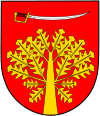
Gmina Sobolew
Gmina Sobolew is a rural gmina (administrative district) in Garwolin County, Masovian Voivodeship, in east-central Poland. Its seat is the village of Sobolew, which lies approximately 18 kilometres (11 mi) east of Garwolin and 71 km (44 mi) south-east of Warsaw.
Gmina Sobolew Sobolew Commune | |
|---|---|
 Flag  Coat of arms | |
| Coordinates (Sobolew): 51°44′23″N 21°40′7″E | |
| Country | |
| Voivodeship | Masovian |
| County | Garwolin |
| Seat | Sobolew |
| Area | |
| • Total | 94.83 km2 (36.61 sq mi) |
| Population (2006) | |
| • Total | 8,312 |
| • Density | 88/km2 (230/sq mi) |
| Website | http://www.sobolew.pl/ |
The gmina covers an area of 94.83 square kilometres (36.6 sq mi), and as of 2006 its total population was 8,312.
Villages
Gmina Sobolew contains the villages and settlements of:
- Anielów
- Chotynia, Chotynia-Kolonia
- Chrusty
- Drobina
- Emerytka, Godzisz
- Gończyce, Grabniak
- Kaleń Drugi, Kaleń Pierwszy
- Karolinów
- Kobusy
- Kownacica
- Leonorów
- Mazurki
- Michałki
- Milanów
- Nowa Krępa
- Nowiny Sobolewskie
- Ostrożeń Drugi
- Ostrożeń Pierwszy
- Poręby
- Przyłęk
- Sobolew
- Sokół
- Teofilów
- Trzcianka
- Uśniak
- Walerków
- Wiktorzyn
- Zaprzytnica
Neighbouring gminas
Gmina Sobolew is bordered by the gminas of Górzno, Łaskarzew, Maciejowice, Trojanów and Żelechów.
gollark: ++tel graph
gollark: +=tel graph
gollark: ++tel graph
gollark: No, not really.
gollark: Cool.
This article is issued from Wikipedia. The text is licensed under Creative Commons - Attribution - Sharealike. Additional terms may apply for the media files.
