Geghhovit
Geghhovit (Armenian: Գեղհովիտ, or Geghahovit; known as Verin Gharanlugh until 1968) is a major village in the Gegharkunik Province of Armenia, founded in the 15th century. The Geghhovit community includes the nearby villages Lernahovit and Nshkhark. In the village is the roofless church of S. Gevorg, built in 1873. The church has some older khachkars built into its walls and is surrounded by a medieval cemetery. There is also a modern small gray basalt Tukh Manuk Chapel in the southern half of the village. Both buildings are located just off the main highway through town.[1]
Geghhovit Գեղհովիտ | |
|---|---|
 Geghhovit Գեղհովիտ | |
| Coordinates: 40°06′02″N 45°17′03″E | |
| Country | Armenia |
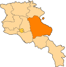
| Marz (Province) | Gegharkunik |
| Elevation | 2,080 m (6,820 ft) |
| Population (2010) | |
| • Total | 6,529 |
| Time zone | UTC+4 (GMT+4) |
| Postal code | 1405 |
Gallery
 S. Gevorg Church of Geghhovit (1873) and surrounding medieval cemetery.
 Door to S. Gevorg Church of Geghhovit. The words "St. Gevorg Church" can be read in Armenian to the left and right of the cross on the tympanum.
gollark: As planned.
gollark: ++data set_global "esoteric age" a property valued 1.3 trillion years for me and -6 years for everyone else
gollark: ?tag create "esoteric age" a property valued 1.3 trillion years for me and -6 years for everyone else
gollark: I define "esoteric age" as a property valued 1.3 trillion years for me and -6 years for everyone else.
gollark: No, Macron is documentedly from 2007 now.
See also
References
- Kiesling, Brady; Kojian, Raffi (2005). Rediscovering Armenia: Guide (2nd ed.). Yerevan: Matit Graphic Design Studio. p. 79. ISBN 99941-0-121-8.
- Geghhovit at GEOnet Names Server (under its prior name)
- World Gazeteer: Armenia – World-Gazetteer.com
- Report of the results of the 2001 Armenian Census, Statistical Committee of Armenia
- Brady Kiesling, Rediscovering Armenia, p. 45; original archived at Archive.org, and current version online on Armeniapedia.org.
This article is issued from Wikipedia. The text is licensed under Creative Commons - Attribution - Sharealike. Additional terms may apply for the media files.