Berdkunk
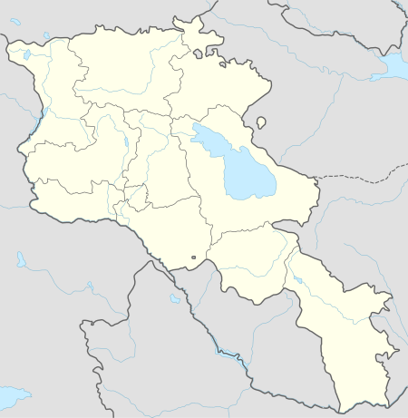
Berdkunk (Armenian: Բերդկունք; also Romanized as Berdkunk’ and Berdkunq; formerly Akhkala and Aghkala) is a small village in the Gegharkunik Province of Armenia. The village was once a transit point on the ancient road between Dvin and Partev. There are cyclopean fortresses nearby with megalithic tombs. One of the fortresses in particular is located along the eastern edge of the village and is known locally as Ishkhanats Amrots or Berdkunk Fortress.[1]
Berdkunk Բերդկունք | |
|---|---|
 Berdkunk Fortress (also: Spitak Berd (White fortress), Aghkala, Ishkhanats Berd), 2-1 Mil. BC, 10th c. | |
 Berdkunk Բերդկունք | |
| Coordinates: 40°26′40″N 45°06′02″E | |
| Country | Armenia |
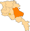
| Marz (Province) | Gegharkunik |
| Elevation | 1,939 m (6,362 ft) |
| Population (2001) | |
| • Total | 253 |
| Time zone | UTC+4 (GMT+4) |
Gallery
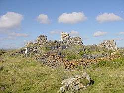
 Berdkunk Fortress, front view
 Berdkunk Fortress
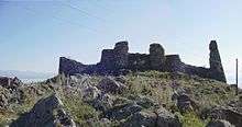
gollark: I think that's quite obviously not a serious idea.
gollark: Yes.
gollark: Oh, I deleted some of your messages to confuse you.
gollark: Do you fear apiohypnoforms?
gollark: And/or sleep deprivation.
See also
References
- Kiesling, Brady; Kojian, Raffi (2005). Rediscovering Armenia: Guide (2nd ed.). Yerevan: Matit Graphic Design Studio. p. 77. ISBN 99941-0-121-8.
- Berdkunk at GEOnet Names Server
- Report of the results of the 2001 Armenian Census, Statistical Committee of Armenia
- Brady Kiesling, Rediscovering Armenia, p. 43; original archived at Archive.org, and current version online on Armeniapedia.org.
This article is issued from Wikipedia. The text is licensed under Creative Commons - Attribution - Sharealike. Additional terms may apply for the media files.