Gallatin Gateway, Montana
Gallatin Gateway is a census-designated place (CDP) in Gallatin County, Montana, United States. As of the 2010 census it had a population of 856.[1]
Gallatin Gateway, Montana | |
|---|---|
 Gallatin Gateway  Gallatin Gateway | |
| Coordinates: 45°35′29″N 111°11′51″W | |
| Country | United States |
| State | Montana |
| County | Gallatin |
| Area | |
| • Total | 5.9 sq mi (15.4 km2) |
| • Land | 5.8 sq mi (15.1 km2) |
| • Water | 0.1 sq mi (0.3 km2) |
| Elevation | 4,953 ft (1,510 m) |
| Population (2010) | |
| • Total | 856 |
| • Density | 56.6/sq mi (21.9/km2) |
| Time zone | UTC-7 (Mountain (MST)) |
| • Summer (DST) | UTC-6 (MDT) |
| ZIP code | 59730 |
| Area code(s) | 406 |
| FIPS code | 30-29875 |
| GNIS feature ID | 2583809 |
The community is located along U.S. Route 191 in the valley of the Gallatin River, a north-flowing tributary of the Missouri River. US 191 leads north then east 13 miles (21 km) to Bozeman and south 28 miles (45 km) to Big Sky. According to the U.S. Census Bureau, the CDP has a total area of 5.9 square miles (15.4 km2), of which 5.8 square miles (15.1 km2) is land and 0.1 square miles (0.3 km2), or 1.83%, is water.[1]
Salesville was one of the pioneer towns, named for Z. Sales, who secured a saw mill started by J. J. Tomlinson, continuing the business on the West Gallatin river several years. With his family, he established the town on his property, the name of the town being changed in 1927 to Gallatin Gateway, by the Milwaukee road, when this town became the terminus of the branch line from Three Forks, carrying passengers for the trip through Yellowstone park by way of Gallatin canyon. The passenger depot was established in the commodious Gallatin Gateway Inn built by the railroad. A good brick school house, some substantial business blocks and comfortable homes are found there.[2]
References
- "Geographic Identifiers: 2010 Demographic Profile Data (G001): Gallatin Gateway CDP, Montana". American Factfinder. U.S. Census Bureau. Retrieved December 21, 2016.
- http://genealogytrails.com/mon/gallatin/earlyhistory.html
Municipalities and communities of Gallatin County, Montana, United States | ||
|---|---|---|
| Cities | 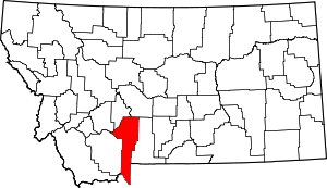 Gallatin County map | |
| Towns |
| |
| CDPs | ||
| Other unincorporated communities | ||
| Footnotes | ‡This populated place also has portions in an adjacent county or counties | |