Churchill, Montana
Churchill is a census-designated place (CDP) in Gallatin County, Montana, United States. The population was 902 at the 2010 census. It is part of the Bozeman, MT Micropolitan Statistical Area. It was formerly part of the Amsterdam-Churchill CDP.
Churchill, Montana | |
|---|---|
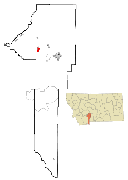 Location of Amsterdam-Churchill, Montana | |
| Coordinates: 45°45′00″N 111°18′37″W | |
| Country | United States |
| State | Montana |
| County | Gallatin |
| Area | |
| • Total | 3.6 sq mi (9.2 km2) |
| • Land | 3.6 sq mi (9.2 km2) |
| • Water | 3.6 sq mi (0.0 km2) |
| Population (2010) | |
| • Total | 902 |
| • Density | 250/sq mi (98/km2) |
| Time zone | UTC-7 (Mountain (MST)) |
| • Summer (DST) | UTC-6 (MDT) |
| Area code(s) | 406 |
| FIPS code | 30-01550 |
Geography
Churchill is located at 45°45′00″N 111°18′37″W (45.749951, -111.310256).[1]
According to the United States Census Bureau, the CDP has a total area of 3.6 square miles (9.3 km2), all of it land.
Demographics
History
Church Hill, or Churchill as it was later shortened by Gallatin County Road Department, is located a 7 miles south of Manhattan, just to east of Amsterdam on a prominent hill. Churchill is at the center of the Montana's largest Dutch settlement that runs from Manhattan south to Little Holland which is 14 miles distant. While Amsterdam may have been the retail center of the Dutch settlement, Churchill was the cultural center with the site of the Dutch community's original church- the 1st Christian Reformed Church, today known as Manhattan Christian Reformed Church; and related parent-operated private P-12 school, Manhattan Christian School; both of which exist today along with Bethel Christian Reformed Church (a spin off of the original church) and Churchill Retirement Home. The large church on the hill is the probable origin of the name, and once was the largest wooden structure west of the Mississippi River.[2] In the late 1890s, Dutch immigrants came to the Gallatin Valley, with the aid of the Manhattan Malting Company, and created a "linear settlement" of homes, farms, and ranches that stretched roughly 14 miles south of Manhattan, with Amsterdam and Churchill roughly in the middle. Recognizing the growth of the community, the Northern Pacific designated a siding called Amsterdam to the west of "the hill" along its Anceney Spur; not to be outdone the C.M. & St. Paul Railway (aka:the Milwaukee Road) created a siding for agricultural goods about two miles to the east of Churchill along its Gallatin Valley Railway called the "Holland Siding", subsequently the "east of the hill" became known on maps as Holland. 7 miles to the south of Churchill, near an area where many Dutch settlers homesteaded, is an area called "Little Holland" and today is marked by one of the two cemeteries established by the original Dutch settlers, the other cemetery is located in Churchill.
References
- "US Gazetteer files: 2010, 2000, and 1990". United States Census Bureau. 2011-02-12. Retrieved 2011-04-23.
- Aarstad, Rich, Ellie Arguimbau, Ellen Baumler, Charlene Porsild, and Brian Shovers. Montana Place Names from Alzada to Zortman Archived October 8, 2009, at the Wayback Machine. Montana Historical Society Press.
External links
Municipalities and communities of Gallatin County, Montana, United States | ||
|---|---|---|
| Cities | 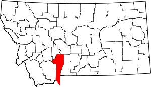 Gallatin County map | |
| Towns |
| |
| CDPs | ||
| Other unincorporated communities | ||
| Footnotes | ‡This populated place also has portions in an adjacent county or counties | |