Jeseník
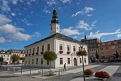
Jeseník (Czech pronunciation: [ˈjɛsɛɲiːk]), Frývaldov until 1947 (Czech pronunciation: [ˈfriːvaldof]; German: Freiwaldau) is a town in the Olomouc Region of the Czech Republic, the administrative capital of Jeseník District.
Jeseník Frývaldov (until 1947) | |
|---|---|
Town | |
 Townhall | |
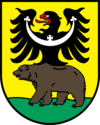
 Flag  Coat of arms | |
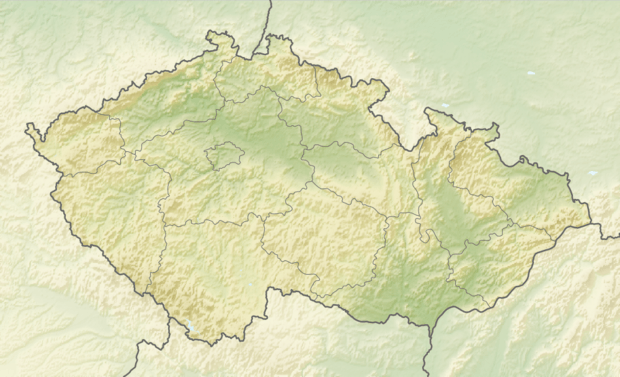
 Jeseník Location in the Czech Republic | |
| Coordinates: 50°13′47″N 17°12′17″E | |
| Country | Czech Republic |
| Region | Olomouc |
| District | Jeseník |
| First mentioned | 1267 |
| Government | |
| • Mayor | Zdeňka Blišťanová (TOP 09) |
| Area | |
| • Total | 38.22 km2 (14.76 sq mi) |
| Elevation | 432 m (1,417 ft) |
| Population (2019-01-01[1]) | |
| • Total | 11,192 |
| • Density | 290/km2 (760/sq mi) |
| Time zone | UTC+1 (CET) |
| • Summer (DST) | UTC+2 (CEST) |
| Postal code | 790 01 |
| Website | www.jesenik.org |
Etymology

The original name was Freiwaldau, deriving from German frei vom Walde. – the name means “free from the woods”. The former Czech name of Frývaldov was a phonetic transcription of the German original (frei=frý, waldau= valdov). After Second World War the town was renamed along with many other towns containing German elements in their names.[2][3] It is named after the surrounding mountains which are called Hrubý Jeseník, or Jeseníky.
Geography
The town is located in the historic Czech Silesia region on the Bělá River, a tributary of the Nysa Kłodzka. It is situated within the Hrubý Jeseník mountain range, north of the Praděd peak. In the west are the foothills of the Golden Mountains
Districts
- Bukovice (Buchelsdorf)
- Dětřichov (Dittershof)
- Jeseník (Freiwaldau)
- Lázně Jeseník (Bad Gräfenberg)
History
Freiwaldau in the Duchy of Silesia, probably founded in the course of the German Ostsiedlung, was first mentioned in 1267, when it already held the status of a town belonging to the territory of the Bishops of Wrocław. With the surrounding villages it became part of the bishops' ecclesiastical Duchy of Nysa in 1290.
In the 14th century Freiwaldau developed as a centre of iron production with several foundries and hammer mills processing the ore from the productive deposits in the surrounding mountains. Later on, the flourishing town was purchased by the Swabian Fugger dynasty. In 1506 the Bishop Johann Thurzó vested its citizens with Bergregal privileges. After the iron ore deposits were exhausted, the Fugger sold the town back to the Wrocław bishops in 1547 and linen weaving became the most important source of income.

Silesia with the Lands of the Bohemian Crown had passed to the Austrian Habsburg Monarchy in 1526; after the First Silesian War it became part of Austrian Silesia in 1742. It remained with the Austrian Empire and the Austro-Hungarian Monarchy, until World War I and the creation of Czechoslovakia in 1918. According to the Austrian administration census of 1910 the town had 6,859 inhabitants, 6,619 of whom had permanent residence there. The census asked people for their native language: 6,588 (99.5%) were speaking German, 16 Czech and 13 Polish. Jews were not allowed to declare Yiddish, most of them thus declared German. Most populous religious groups were Roman Catholics with 6,552 (95.5%), followed by Protestants with 208 (3%) and the Jews with 83 (1.2%).[4]
The Freiwaldau massacre
On November 25, 1931, the local Communist party organised a hunger march of around 1,000 unemployed stoneworkers ('Steinklopfer') to Freiwaldau. The police chief at Setzdorf instructed his men to prevent the demonstration from reaching the town. The police forced the marchers to take an alternative route through the forest. The police soon caught up with them at Nieder-Lindewiese, and a clash ensued during which the marchers threw sticks, stones and other objects at the gendarmes. After two stones hit the commander of the unit, First Lieutenant Oldřich Jirkovský, on the forehead, gave his men the order to fire on the crowd. As a result, ten people, including six women - among them a 60-year-old woman and a 14-year-old girl - were killed and fifteen men and women seriously injured and taken to the hospital in Freiwaldau. The Vienna Neue Zeitung attributed the march to the growing indebtedness of local stone- and chalkworkers, who could no longer earn enough for subsistence.[5][6]
From 1938 to 1945 it was one of the municipalities in Sudetenland. The German population was expelled according to the Beneš Decrees in 1945.
Notable people
- Carl Ditters von Dittersdorf (1739–1799), composer and violinist
- Vincenz Priessnitz (1799), founder of Hydropathy
- Oscar Paul (1836–1898), music historian (de)
- Adolph (Adolf Gustav) Weiß (1837–1894, Prague), botanist
- Edmund Weiss (Weiß) (1837–1917), astronomer
- Walter Reder (born 1915), Waffen-SS officer and a convicted war criminal
- Adolf Kettner (1849, Schwarzwasser bei Freiwaldau - 1932), local historian
- Károly Khuen-Héderváry (1849–1918), Hungarian politician
- Oskar Hein (1863–1940), politician, writer
- Emi Hauck (1866–1936), physician, mayor
- Siegmund Hein (1868–1945, Vienna), scientist
- Richard (Victor) Werner (1875–1943, Theresienstadt), physician
- Franz Wittelsbach, Prinz von Bayern (1919–1999), a son of Prince Georg of Bavaria[7]
- Franz Karl Mohr (1887–1965), Sudeten and American germanist and poet
- Engelbert Kaps (1888–1975), sculptor[8]
- Josef Werdecker (1907–1979), geographer
Twin towns — sister cities
Jeseník is twinned with:[9]
References
- "Population of municipalities of the Czech republic". Czech Statistical Office. Retrieved 2019-04-30.
- "Sbírka zákonu a nařízení republiky Československé" (4). Ministry of the Interior of the Czech Republic. 31 January 1948. p. 284.
- "Mrdákov, Sračkov, Mrchojedy. Obce touží po jiném názvu". Tyden.cz. Retrieved 27 June 2014.
- Ludwig Patryn (ed): Die Ergebnisse der Volkszählung vom 31. Dezember 1910 in Schlesien, Troppau 1912.
- ÖNB/ANNO AustriaN Newspaper Online
- ÖNB/ANNO AustriaN Newspaper Online
- http://prinzvonbayern.weebly.com/index.html
- "Archived copy". Archived from the original on 2010-01-11. Retrieved 2009-08-30.CS1 maint: archived copy as title (link)
- "Partnerská města" (in Czech). Město Jeseník. Retrieved 2019-08-23.
| Wikimedia Commons has media related to Jeseník. |