Fox Park, Wyoming
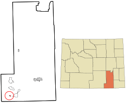
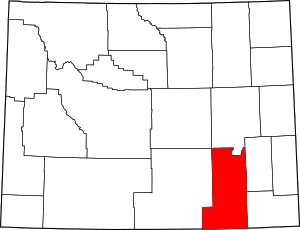
Fox Park is a census-designated place (CDP) in Albany County, Wyoming, United States. The population was 22 at the 2010 census.
Fox Park, Wyoming | |
|---|---|
 Location in Albany County and the state of Wyoming. | |
 Fox Park, Wyoming Location in the United States | |
| Coordinates: 41°4′46″N 106°9′9″W[1] | |
| Country | |
| State | |
| County | |
| Area | |
| • Total | 1.0 sq mi (3 km2) |
| • Land | 1.0 sq mi (3 km2) |
| • Water | 0 sq mi (0 km2) |
| Elevation | 9,062 ft (2,762 m) |
| Population | |
| • Total | 22 |
| • Density | 22/sq mi (8.5/km2) |
| Time zone | UTC-7 (Mountain (MST)) |
| • Summer (DST) | UTC-6 (MDT) |
| Area code(s) | 307 |
| FIPS code | 56-29390[3] |
| GNIS feature ID | 1599838[4] |
Geography
According to the United States Census Bureau, the CDP has a total area of 1.0 square miles (28.5 km²), all of which was land.[5]
The CDP is located entirely within the Medicine Bow National Forest.
Fox Park experiences a subarctic climate (Köppen climate classification Dfc) due to its elevation. Winters are long and cold, with highs usually remaining at or below freezing, and lows often dropping below zero. Summers are refreshingly warm, but with lows still dropping to freezing. Snowfall is very high, averaging 180 inches per year, mostly falling between October and May, but snow during the months of September and June is not rare, and usually happens every couple of years. Usually no month of the year is frost free. Fox Park is the highest community in the state of Wyoming, at an elevation of 9,062 ft, as well as one of the coldest settlements.[6][7]
| Climate data for Fox Park | |||||||||||||
|---|---|---|---|---|---|---|---|---|---|---|---|---|---|
| Month | Jan | Feb | Mar | Apr | May | Jun | Jul | Aug | Sep | Oct | Nov | Dec | Year |
| Average high °F (°C) | 26.3 (−3.2) |
29.3 (−1.5) |
33.9 (1.1) |
42.5 (5.8) |
53.5 (11.9) |
65.3 (18.5) |
72.3 (22.4) |
70 (21) |
62.8 (17.1) |
51.9 (11.1) |
36.1 (2.3) |
28.7 (−1.8) |
47.7 (8.7) |
| Daily mean °F (°C) | 15.9 (−8.9) |
17.8 (−7.9) |
21.8 (−5.7) |
30.5 (−0.8) |
40 (4) |
49.2 (9.6) |
54.8 (12.7) |
53 (12) |
46.3 (7.9) |
37.3 (2.9) |
24.7 (−4.1) |
18.1 (−7.7) |
34.1 (1.2) |
| Average low °F (°C) | 5.4 (−14.8) |
6.3 (−14.3) |
9.7 (−12.4) |
18.5 (−7.5) |
26.4 (−3.1) |
33.1 (0.6) |
37.3 (2.9) |
35.9 (2.2) |
29.7 (−1.3) |
22.7 (−5.2) |
13.2 (−10.4) |
7.5 (−13.6) |
20.5 (−6.4) |
| Average precipitation inches (mm) | 1.51 (38) |
1.11 (28) |
1.37 (35) |
1.41 (36) |
1.45 (37) |
1.57 (40) |
1.53 (39) |
1.60 (41) |
1.23 (31) |
0.97 (25) |
1.13 (29) |
1.26 (32) |
16.14 (411) |
| Average snowfall inches (cm) | 28.6 (73) |
21.9 (56) |
26.9 (68) |
25.3 (64) |
11.2 (28) |
1.8 (4.6) |
0 (0) |
0.1 (0.25) |
4.4 (11) |
10.8 (27) |
22.3 (57) |
26.8 (68) |
180.1 (456.85) |
Education
Public education in the community of Albany is provided by Albany County School District #1.
References
- "US Gazetteer files: 2010, 2000, and 1990". United States Census Bureau. 2011-02-12. Retrieved 2011-04-23.
- "2010 City Population and Housing Occupancy Status". U.S. Census Bureau. Retrieved June 4, 2013.
- "U.S. Census website". United States Census Bureau. Retrieved 2008-01-31.
- "US Board on Geographic Names". United States Geological Survey. 2007-10-25. Retrieved 2008-01-31.
- "2010 Wyoming Place Names". U.S. Census Bureau. Retrieved June 4, 2013.
- "Worldwide Elevation Finder". elevation.maplogs.com. Retrieved 2020-04-27.
- "FOXPARK, WYOMING - Climate Summary". wrcc.dri.edu. Retrieved 2020-04-27.
