Fordon, East Riding of Yorkshire
Fordon is a village in the East Riding of Yorkshire, England, near the border with North Yorkshire. It is situated approximately 8 miles (13 km) south of Scarborough and 10 miles (16 km) north-west of Bridlington.
| Fordon | |
|---|---|
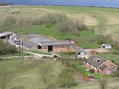 View of Fordon | |
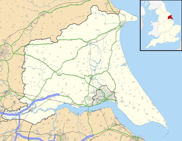 Fordon Location within the East Riding of Yorkshire | |
| OS grid reference | TA050751 |
| • London | 185 mi (298 km) S |
| Civil parish | |
| Unitary authority | |
| Ceremonial county | |
| Region | |
| Country | England |
| Sovereign state | United Kingdom |
| Post town | DRIFFIELD |
| Postcode district | YO25 |
| Dialling code | 01262 |
| Police | Humberside |
| Fire | Humberside |
| Ambulance | Yorkshire |
| UK Parliament | |
It forms part of the civil parish of Wold Newton.
There is a small church dedicated to St James that is now a Grade II* listed building.[1]
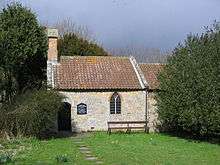
St James' Church
The name Fordon is thought to mean 'In front of the hill'.[2]
In 1823 Fordon was in the parish of Hunmanby and the Wapentake of Dickering. Occupations at the time included three farmers.[3]
References
- Historic England. "Church of St James (1162675)". National Heritage List for England. Retrieved 24 January 2013.
- Smith, A.H. (1937). The Place-Names of The East Riding of Yorkshire and York. Cambridge University Press.
- Baines, Edward (1823). History, Directory and Gazetteer of the County of York. p. 207.
- Gazetteer — A–Z of Towns Villages and Hamlets. East Riding of Yorkshire Council. 2006. p. 5.
External links

- Historic England. "St James' Church (1162675)". National Heritage List for England.
- Fordon in the Domesday Book
This article is issued from Wikipedia. The text is licensed under Creative Commons - Attribution - Sharealike. Additional terms may apply for the media files.