Fontanelle, Iowa
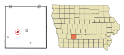
Fontanelle is a city in Summerset Township, Adair County, Iowa, United States. The population was 672 at the 2010 census.
Fontanelle, Iowa | |
|---|---|
 Location of Fontanelle, Iowa | |
| Coordinates: 41°17′24″N 94°33′44″W | |
| Country | |
| State | |
| County | Adair |
| Township | Summerset |
| Area | |
| • Total | 0.96 sq mi (2.48 km2) |
| • Land | 0.96 sq mi (2.48 km2) |
| • Water | 0.00 sq mi (0.00 km2) |
| Elevation | 1,345 ft (410 m) |
| Population | |
| • Total | 672 |
| • Estimate (2019)[3] | 622 |
| • Density | 650.63/sq mi (251.28/km2) |
| Time zone | UTC-6 (Central (CST)) |
| • Summer (DST) | UTC-5 (CDT) |
| ZIP code | 50846 |
| Area code(s) | 641 |
| FIPS code | 19-28290 |
| GNIS feature ID | 0456661 |
History
Fontanelle was platted in 1855.[4] It is named for chief Logan Fontanelle of the Omaha tribe, son of the French fur trader Lucien Fontanelle of the American Fur Company and an Omaha tribeswoman.[5][6]
Geography
Fontanelle is located at 41°17′24″N 94°33′44″W (41.289995, -94.562230).[7]
According to the United States Census Bureau, the city has a total area of 0.96 square miles (2.49 km2), all land.[8]
Demographics
| Year | Pop. | ±% |
|---|---|---|
| 1880 | 563 | — |
| 1890 | 830 | +47.4% |
| 1900 | 853 | +2.8% |
| 1910 | 789 | −7.5% |
| 1920 | 869 | +10.1% |
| 1930 | 833 | −4.1% |
| 1940 | 797 | −4.3% |
| 1950 | 812 | +1.9% |
| 1960 | 729 | −10.2% |
| 1970 | 752 | +3.2% |
| 1980 | 805 | +7.0% |
| 1990 | 712 | −11.6% |
| 2000 | 692 | −2.8% |
| 2010 | 672 | −2.9% |
| 2019 | 622 | −7.4% |
| Source:"American FactFinder". United States Census Bureau. Archived from the original on 2020-02-12. Retrieved 2020-03-28. and Iowa Data Center Source: | ||
2010 census
As of the census[2] of 2010, there were 672 people, 304 households, and 164 families living in the city. The population density was 700.0 inhabitants per square mile (270.3/km2). There were 336 housing units at an average density of 350.0 per square mile (135.1/km2). The racial makeup of the city was 99.7% White, 0.1% from other races, and 0.1% from two or more races. Hispanic or Latino of any race were 0.6% of the population.
There were 304 households of which 25.7% had children under the age of 18 living with them, 44.1% were married couples living together, 7.2% had a female householder with no husband present, 2.6% had a male householder with no wife present, and 46.1% were non-families. 41.4% of all households were made up of individuals and 22.7% had someone living alone who was 65 years of age or older. The average household size was 2.11 and the average family size was 2.89.
The median age in the city was 48.2 years. 22.2% of residents were under the age of 18; 3.8% were between the ages of 18 and 24; 20.2% were from 25 to 44; 27.4% were from 45 to 64; and 26.3% were 65 years of age or older. The gender makeup of the city was 47.6% male and 52.4% female.
2000 census
As of the census[10] of 2000, there were 692 people, 305 households, and 186 families living in the city. The population density was 775.6 people per square mile (300.2/km2). There were 328 housing units at an average density of 367.6 per square mile (142.3/km2). The racial makeup of the city was 99.42% White, and 0.58% from two or more races. Hispanic or Latino of any race were 0.58% of the population.
There were 305 households out of which 23.0% had children under the age of 18 living with them, 51.5% were married couples living together, 7.2% had a female householder with no husband present, and 38.7% were non-families. 35.1% of all households were made up of individuals and 22.0% had someone living alone who was 65 years of age or older. The average household size was 2.11 and the average family size was 2.70.
20.2% were under the age of 18, 7.2% from 18 to 24, 19.4% from 25 to 44, 18.9% from 45 to 64, and 34.2% were 65 years of age or older. The median age was 48 years. For every 100 females, there were 76.5 males. For every 100 females age 18 and over, there were 76.4 males.
The median income for a household in the city was $31,328, and the median income for a family was $39,861. Males had a median income of $30,000 versus $20,550 for females. The per capita income for the city was $16,352. About 3.6% of families and 5.8% of the population were below the poverty line, including 10.7% of those under age 18 and 4.8% of those age 65 or over.

Education
Nodaway Valley Community School District serves the community.[11] It was formed on July 1, 2000 by the consolidation of the districts of Greenfield and Bridgewater-Fontanelle.[12] Nodaway Valley High School is the joint high school.
Media
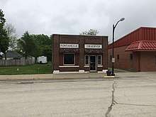
The town's newspaper is The Fontanelle Observer, which now has a page on the website of the Creston News Advertiser. The office of the Observer is on 5th Street.
References
- "2019 U.S. Gazetteer Files". United States Census Bureau. Retrieved July 17, 2020.
- "American FactFinder". United States Census Bureau. Archived from the original on 2020-02-12. Retrieved 2012-05-11.
- "Population and Housing Unit Estimates". United States Census Bureau. May 24, 2020. Retrieved May 27, 2020.
- History of Guthrie and Adair Counties, Iowa. Continental Historical Company. 1884. pp. 936.
- Gannett, Henry (1905). The Origin of Certain Place Names in the United States. Govt. Print. Off. pp. 128.
- Fontanelle Community Profile
- "US Gazetteer files: 2010, 2000, and 1990". United States Census Bureau. 2011-02-12. Retrieved 2011-04-23.
- "US Gazetteer files 2010". United States Census Bureau. Archived from the original on 2012-07-02. Retrieved 2012-05-11.
- "Census of Population and Housing". Census.gov. Archived from the original on April 26, 2015. Retrieved June 4, 2015.
- "American FactFinder". United States Census Bureau. Archived from the original on 2020-02-12. Retrieved 2008-01-31.
- "Nodaway Valley" (PDF). Iowa Department of Education. Retrieved 2019-08-03.
- "REORGANIZATION & DISSOLUTION ACTIONS SINCE 1965-66." Iowa Department of Education. Retrieved on July 20, 2018.
Gallery
 Fontanelle's water tower, on 5th Street