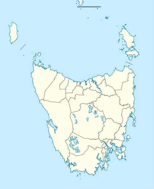
Flowerdale, Tasmania
Flowerdale is a locality and small rural community of Waratah-Wynyard, in north-west Tasmania. Significant geographic features include the Inglis River and the confluence of its largest tributary, the Flowerdale River. The 2011 census determined a population of 324 for the state suburb of Flowerdale, which includes Flowerdale and the nearby Table Cape locality.[1]
| Flowerdale Tasmania | |||||||||||||||
|---|---|---|---|---|---|---|---|---|---|---|---|---|---|---|---|
 Flowerdale | |||||||||||||||
| Coordinates | 40°58′12″S 145°39′50″E | ||||||||||||||
| Population | 324 (2011)[1] | ||||||||||||||
| Postcode(s) | 7325 | ||||||||||||||
| Elevation | 24 m (79 ft) | ||||||||||||||
| Location | 6 km (4 mi) NW of Wynyard, Tasmania | ||||||||||||||
| LGA(s) | Waratah-Wynyard | ||||||||||||||
| Region | North West Tasmania | ||||||||||||||
| State electorate(s) | Braddon | ||||||||||||||
| Federal Division(s) | Braddon | ||||||||||||||
| |||||||||||||||
History
Flowerdale Post Office opened on 1 March 1891 and closed in 1981.[2]
The Preolenna line was a railway line which extended from the Flowerdale junction, to as far as Maweena, a small distance past Preolenna. It was first opened in 1917 but was soon closed in 1931 - in one of its annual reports, the TGR operators had described the traffic along the route as "infintecimal".[3]
Notes and references
- Australian Bureau of Statistics (31 October 2012). "Flowerdale (State Suburb SCC)". 2011 Census QuickStats. Retrieved 19 January 2016.

- Premier Postal History. "Post Office List". Premier Postal Auctions. Retrieved 16 June 2012.
- "Preolenna Line". railtasmania.com. Rail Tasmania. Retrieved 19 January 2016.
gollark: You don't need to provide a video just to quickly answer that!
gollark: …
gollark: Yes.
gollark: <@409887156673183754> https://i.ale32bit.me/QXE1q.png Well?
gollark: <@237328509234708481> Can't you turn off its AI?
This article is issued from Wikipedia. The text is licensed under Creative Commons - Attribution - Sharealike. Additional terms may apply for the media files.