Wynyard, Tasmania
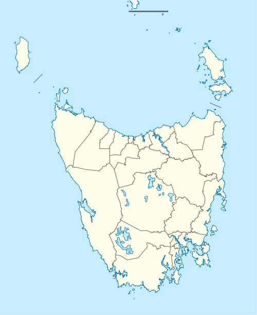
Wynyard is a rural town on the north-west coast of Tasmania, Australia, about 17 kilometres (11 mi) west of Burnie. At the 2011 census Wynyard had an urban population of 5,061[1] and a total greater area population of 5,990.[3] The town is a regional hub servicing the surrounding rural areas, the adjacent Burnie Wynyard Airport provides commercial flights to Melbourne and other districts. The main council offices for the Waratah-Wynyard local government area are located in Wynyard.
| Wynyard Tasmania | |||||||||
|---|---|---|---|---|---|---|---|---|---|
Table Cape as seen at dusk | |||||||||
 Wynyard | |||||||||
| Coordinates | 40°59′2″S 145°43′4″E | ||||||||
| Population | 5,061 (2011 census)[1] | ||||||||
| Postcode(s) | 7325 | ||||||||
| Elevation | 12 m (39 ft)[2] | ||||||||
| Location |
| ||||||||
| LGA(s) | Waratah-Wynyard | ||||||||
| Region | North West Tasmania | ||||||||
| State electorate(s) | Braddon | ||||||||
| Federal Division(s) | Braddon | ||||||||
| |||||||||
History
Three ex-convict Alexander brothers established a settlement, Alexandria, on the west, or Table Cape, side of the Inglis River in the 1850s. They bought large areas of farmland on Table Cape and built several small ships for produce and timber trading. Shortly afterwards, Wynyard town, on the east side of the river, was laid out, but lagged well behind Alexandria which had a church and several shops including a blacksmith and general store.[4][5] After the Inglis River was bridged in 1861, Alexandria began to fade and Wynyard, with better wharfing, became the district's centre of commerce.
Wynyard was probably named after Major-General Edward Buckley Wynyard in the early 1850s.[6][7] Table Cape Post Office opened around 1856 and was renamed Wynyard in 1882.[8]
Wynyard handled more shipping than Burnie in the late nineteenth century and its population reached 500 by 1900. However, in the 20th century Burnie flourished and become the dominant regional and industrial hub for the region.[5]
Community
Radio
Coast FM is a volunteer community radio station servicing the North-West coast of Tasmania, with the studio based in Wynyard.
Sports
The Wynyard Yacht Club was established in 1961 and is situated near the mouth of the Inglis River,[9] the club has received national recognition for its inclusiveness programs.[10]
Wonders of Wynyard
The Wonders of Wynyard visitor information centre hosts a substantial classic vintage cars collection which was donated to the Waratah-Wynyard Council by the collector and restorer, Francis Ransley.[11]
Education
There are currently two government funded public schools in Wynyard, including Table Cape Primary School and Wynyard High School. There is also a catholic primary school, St Brigid's, adjacent to the catholic church of the same name.
Previously, Wynyard Primary School (located at Gibbons Street) and Inglis Primary School (located at Bowick Street) existed separately. Both were renamed to Table Cape Primary School in 1998. The two school campuses were then merged in 2009, with the closing of the Bowick Street campus.[12]
Geographical features
Freestone Cove
Freestone Cove is a small sheltered bay on the northern fringes of Wynyard, towards Table Cape.
Fossil Bluff
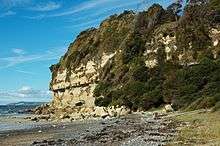
Fossil bluff is a small protrusion of sandstone cliffs rising about 30 metres (98 ft) from the coastline at Freestone Cove. In the 19th century, it was the discovery site of Australia's oldest fossil marsupial, Wynyardia bassiana, an extinct possum-like animal from the early Miocene (about 25 million years ago). Also recovered was an extinct genus of whale, Prosqualodon.[13][14]
Aboriginal fish traps
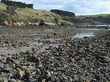
It is believed the Aboriginal Tommeginer clan built tidal fish traps with rocks at Freestone Cove, the rocks are still evident today and are protected under the Aboriginal Relics Act.[15] The Tommeginer tribe lived in the region along the coastline around Wynyard and Table Cape until soon after the arrival of Europeans in the 19th century.[16]
A considerable number of tidal fish traps have been found in the north and north-west of the state. The phenomena is attributed to the mean tidal range of two metres along this stretch of coastline, which is ideal for this type of construction. Whilst some of these traps were certainly built by Europeans, there is good reason to believe others were of Aboriginal construction, such as at Freestone Cove. Three other traps located at nearby Rocky Cape, Sisters Beach and Boat Harbour do not have established European origins, furthermore, all are located within the territory which was occupied by the Tommeginer tribe.[15]
Tidal fish traps must be located close to settlements or camps so that they can be monitored. Because as the tide ebbs, any fish caught in the shallows fall easy prey to scavenging seabirds. The Freestone Cove traps are located a considerable distance from the nearest early European settlement of Alexandria, but were close to known Aboriginal campsites and several middens have been located along the shoreline nearby.[17]
Inglis River
Wynyard is located around the mouth of the Inglis River, which extends approximately 61 kilometres to the Campbell Ranges near Takone.[18]
Table Cape
Table Cape is a volcanic plug located about 4 kilometres (2.5 mi) north of Wynyard, the northern and eastern faces of the geological feature rise steeply from Bass Strait to a height of approximately 170 metres (560 ft) above sea level.[19] The area is renowned for the annual flowering of tulips during spring and accompanying tulip festival.[20] Situated on the edge of Table Cape is the heritage-listed Table Cape Lighthouse which remains in operation today. The lighthouse stands about 25 metres (82 ft) tall and has a maximum nautical range of 16 nautical miles (30 km; 18 mi).[21][22]
Climate
| Climate data for Wynyard Airport (1947–2016) | |||||||||||||
|---|---|---|---|---|---|---|---|---|---|---|---|---|---|
| Month | Jan | Feb | Mar | Apr | May | Jun | Jul | Aug | Sep | Oct | Nov | Dec | Year |
| Record high °C (°F) | 35.1 (95.2) |
32.6 (90.7) |
30.3 (86.5) |
27.2 (81.0) |
21.0 (69.8) |
19.6 (67.3) |
17.7 (63.9) |
19.3 (66.7) |
20.6 (69.1) |
24.5 (76.1) |
30.5 (86.9) |
30.5 (86.9) |
35.1 (95.2) |
| Average high °C (°F) | 21.5 (70.7) |
21.8 (71.2) |
20.2 (68.4) |
17.6 (63.7) |
15.2 (59.4) |
13.4 (56.1) |
12.7 (54.9) |
13.3 (55.9) |
14.5 (58.1) |
16.2 (61.2) |
18.2 (64.8) |
19.7 (67.5) |
17.0 (62.6) |
| Average low °C (°F) | 11.1 (52.0) |
11.7 (53.1) |
9.6 (49.3) |
7.1 (44.8) |
5.3 (41.5) |
4.2 (39.6) |
3.5 (38.3) |
4.0 (39.2) |
5.0 (41.0) |
6.1 (43.0) |
8.2 (46.8) |
9.6 (49.3) |
7.1 (44.8) |
| Record low °C (°F) | 0.6 (33.1) |
1.1 (34.0) |
−0.2 (31.6) |
−2.3 (27.9) |
−2.7 (27.1) |
−3.6 (25.5) |
−3.6 (25.5) |
−3.1 (26.4) |
−2.5 (27.5) |
−1.6 (29.1) |
−0.6 (30.9) |
0.0 (32.0) |
−3.6 (25.5) |
| Average precipitation mm (inches) | 43.8 (1.72) |
47.2 (1.86) |
48.5 (1.91) |
71.1 (2.80) |
99.2 (3.91) |
109.2 (4.30) |
132.5 (5.22) |
117.7 (4.63) |
97.2 (3.83) |
95.3 (3.75) |
74.8 (2.94) |
64.1 (2.52) |
975.4 (38.40) |
| Average rainy days (≥ 0.2 mm) | 9.1 | 8.8 | 11.0 | 13.5 | 17.1 | 17.9 | 20.6 | 20.8 | 18.1 | 16.9 | 13.7 | 12.3 | 179.8 |
| Source: Bureau of Meteorology[23] | |||||||||||||
Notable residents
- F. M. Alexander the creator of the Alexander technique was born on the northern bank of the Inglis River at a settlement called Alexandria, situated about three km upstream from the river mouth. He later moved to Waratah, Melbourne, London and New York to pursue acting and teaching.
- Carla Boyd is a retired Australian women's basketball player who was born in Wynyard. Boyd Competed at the 1996 and 2000 Olympic Games, and the 1998 World Championship, winning medals at all three events (1 silver and 2 bronze).
Gallery
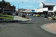 Goldie Street
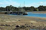 Wharf on the Inglis River at low tide
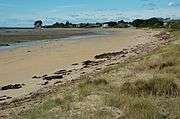 East Wynyard Beach
References
| Wikimedia Commons has media related to Wynyard, Tasmania. |
- Australian Bureau of Statistics (31 October 2012). "Wynyard (Urban Centre/Locality)". 2011 Census QuickStats. Retrieved 4 March 2015.

- Bureau of Meteorology. Retrieved on 2007-11-17.
- Australian Bureau of Statistics (31 October 2012). "Wynyard (Statistical Area Level 2)". 2011 Census QuickStats. Retrieved 4 March 2015.

- "History of Alexandria". stayalexandria.com. Alexandria B&B. Retrieved 31 December 2016.
- Pink, Kerry (2006). "Wynyard". The companion to Tasmanian History. University of Tasmania. Retrieved 28 November 2016.
- H. A. Nichols (6 October 1923). "Glimpses of the Past". The Advocate. Burnie, Tasmania. p. 14. Retrieved 13 April 2015 – via National Library of Australia.
- "Table Cape Became Wynyard About 100 Years Ago". The Advocate. Burnie, Tasmania. 30 January 1954. p. 11. Retrieved 14 April 2015 – via National Library of Australia.
- Premier Postal History. "Post Office List". Premier Postal Auctions. Retrieved 16 June 2012.
- "Wynyard Yacht Club Inc: About". Wynyard Yacht Club Inc. Retrieved 4 January 2017.
- "Wynyard Yacht Club beats some of country's best to be named top yacht club in Australia". abc.net.au/news. Australian Broadcasting Corporation. 18 October 2014. Retrieved 4 January 2017.
- The Original Rev Head (advertisement) (YouTube). Wynyard, Tasmania: Discover Tasmania. 25 February 2016. Retrieved 31 December 2016.
- Table Cape Primary School TA2116 [Records], LINC Tasmania, 1998, retrieved 1 January 2017
- Quilty, Patrick. "Fossils". The companion to Tasmanian history. University of Tasmania. Retrieved 31 December 2016.
- "Fossil Bluff". visitwaratahwynyard.com.au. Waratah-Wynyard Council. Retrieved 31 December 2016.
- McFarlane, Ian (October 2002). "1". Aboriginal Society in North West Tasmania: Dispossession and Genocide (PDF) (Ph.D). University of Tasmania. Retrieved 31 December 2016.
- The Aboriginal Tribes of North West Tasmania: A History, by Ian McFarlane, 2008, published by Riawunna, Fullers Bookshop and UTas.
- Johnson, Murray; McFarlane, Ian (2015). Van Diemen's Land An Aboriginal History. Tasmania: NewSouth Publishing. ISBN 9781742234212. Retrieved 4 January 2017.
- Warfe, Danielle (December 2003). "Aquatic Ecology of Rivers in the Inglis-Flowerdale Catchment" (PDF). dpipwe.tas.gov.au. Department of Primary Industries, Water and Environment. Retrieved 1 January 2017.
- R. D. Gee (1971). Geological Survey Explanatory Report: Table Cape (PDF) (Report). Tasmania Department of Mines. p. 36. Retrieved 31 December 2016.
- Sayer, Luke (31 July 2015). "Tulip festival a bloomin' wonder for community". The Advocate. Fairfax Regional Media. Retrieved 13 August 2016.
- Searle, Garry. "SeaSide Lights: Table Cape". seasidelights.com.au. Garry Searle. Retrieved 31 December 2016.
- Table Cape Lighthouse – Wynyard Visitor Information Centre booket. Waratah-Wynyard Council, Tasmania Parks and Wildlife Service and Australian federal government. 2010. pp. 2–11.
- "Wynyard Airport Climate Statistics". Bureau of Meteorology. Retrieved 31 December 2016.