Fierenana, Moramanga
Fierenana is a town and commune (Malagasy: kaominina) in Madagascar. It belongs to the district of Moramanga, which is a part of Alaotra-Mangoro Region. The population of the commune was estimated to be approximately 9,000 in 2001 commune census.[2]
Fierenana | |
|---|---|
 Fierenana Location in Madagascar | |
| Coordinates: 18°29′S 48°24′E | |
| Country | |
| Region | Alaotra-Mangoro |
| District | Moramanga |
| Elevation | 946 m (3,104 ft) |
| Population (2001)[2] | |
| • Total | 9,000 |
| Time zone | UTC3 (EAT) |
Primary and junior level secondary education are available in town. The majority 98% of the population of the commune are farmers. The most important crop is rice, while other important products are coffee, beans and cassava. Services provide employment for 2% of the population.[2]
References and notes
- Estimated based on DEM data from Shuttle Radar Topography Mission
- "ILO census data". Cornell University. 2002. Retrieved 2008-03-24.
| Ambatondrazaka | 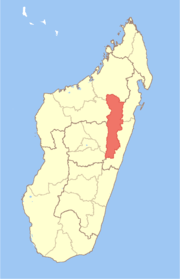 | |
|---|---|---|
| Amparafaravola | ||
| Andilamena | ||
| Anosibe An'ala |
| |
| Moramanga | ||
gollark: Fascinating.
gollark: According to what, the grammar police?
gollark: Ironically, the last one actually contains a mistake.
gollark: You should talk to the heavserver grammar police if you dislike us, really.
gollark: Like that weird rule about the ordering of adjectives.
This article is issued from Wikipedia. The text is licensed under Creative Commons - Attribution - Sharealike. Additional terms may apply for the media files.