Antanandava, Ambatondrazaka
Antanandava is a town and commune (Malagasy: kaominina) in Madagascar. It belongs to the district of Ambatondrazaka, which is a part of Alaotra-Mangoro Region. The population of the commune was estimated to be approximately 8,000 in 2001 commune census.[2]
Antanandava | |
|---|---|
 Antanandava Location in Madagascar | |
| Coordinates: 17°27′S 48°40′E | |
| Country | |
| Region | Alaotra-Mangoro |
| District | Ambatondrazaka |
| Elevation | 847 m (2,779 ft) |
| Population (2001)[2] | |
| • Total | 8,000 |
| Time zone | UTC3 (EAT) |
Only primary schooling is available. The majority 85% of the population of the commune are farmers, while an additional 4% receives their livelihood from raising livestock. The most important crops are rice and peanuts; also maize is an important agricultural product. Services provide employment for 1% of the population. Additionally fishing employs 10% of the population.[2]
Situated close to the commune is the Zahamena National Park.
References and notes
- Estimated based on DEM data from Shuttle Radar Topography Mission
- "ILO census data". Cornell University. 2002. Retrieved 2008-03-06.
| Ambatondrazaka | 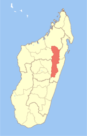 | |
|---|---|---|
| Amparafaravola | ||
| Andilamena | ||
| Anosibe An'ala |
| |
| Moramanga | ||
gollark: Chromebooks *are* known to be bad.
gollark: Teach you to do what exactly?
gollark: For efficiency.
gollark: If you're using C, you might as well just `while (1) fork()`.
gollark: I have a thing monitoring it from someone else's VPS.
This article is issued from Wikipedia. The text is licensed under Creative Commons - Attribution - Sharealike. Additional terms may apply for the media files.