Ferreira do Zêzere
Ferreira do Zêzere (Portuguese pronunciation: [fɨˈʁɐjɾɐ ðu ˈzezɨɾ(ɨ)] (![]()
Ferreira do Zêzere | |
|---|---|
 Flag  Coat of arms | |
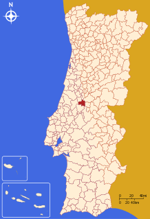 | |
| Coordinates: 39°41′N 8°17′W | |
| Country | |
| Region | Centro |
| Intermunic. comm. | Médio Tejo |
| District | Santarém |
| Parishes | 7 |
| Government | |
| • President | Jacinto Lopes (PSD) |
| Area | |
| • Total | 190.38 km2 (73.51 sq mi) |
| Population (2011) | |
| • Total | 8,619 |
| • Density | 45/km2 (120/sq mi) |
| Time zone | UTC±00:00 (WET) |
| • Summer (DST) | UTC+01:00 (WEST) |
| Local holiday | Saint Anthony June 13 |
| Website | http://www.cm-ferreiradozezere.pt |
Parishes
Administratively, the municipality is divided into 7 civil parishes (freguesias):[3]
- Águas Belas
- Areias e Pias
- Beco
- Chãos
- Ferreira do Zêzere
- Igreja Nova do Sobral
- Nossa Senhora do Pranto
History
This old village, founded by Pedro Ferreira and his wife in the 13th century is actually one of the most touristic villages in the district of Santarém. In the surroundings of Ferreira do Zêzere there is the medieval Vila de Dornes with an excellent view over the Zêzere River and a classified Templar Tower.
gollark: It could still be triangular numbers.
gollark: Yes.
gollark: It's easy to make data fit after it's been generated.
gollark: Yes it does.
gollark: π² ≈ g
References
- Instituto Nacional de Estatística
- "Áreas das freguesias, concelhos, distritos e país". Archived from the original on 2018-11-05. Retrieved 2018-11-05.
- Diário da República. "Law nr. 11-A/2013, page 552 49" (pdf) (in Portuguese). Retrieved 22 July 2014.
External links
This article is issued from Wikipedia. The text is licensed under Creative Commons - Attribution - Sharealike. Additional terms may apply for the media files.