Salvaterra de Magos
Salvaterra de Magos (Portuguese pronunciation: [ˌsalvɐˈtɛʁɐ ðɨ ˈmaɣuʃ] (![]()
Salvaterra de Magos | |
|---|---|
 Flag  Coat of arms | |
 | |
| Coordinates: 39°01′N 8°47′W | |
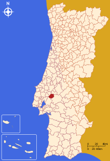
| Country | |
| Region | Alentejo |
| Intermunic. comm. | Lezíria do Tejo |
| District | Santarém |
| Parishes | 4 |
| Government | |
| • President | Hélder Manuel Ramalho de Sousa Esménio (PS) |
| Area | |
| • Total | 243.93 km2 (94.18 sq mi) |
| Population (2011) | |
| • Total | 22,159 |
| • Density | 91/km2 (240/sq mi) |
| Time zone | UTC±00:00 (WET) |
| • Summer (DST) | UTC+01:00 (WEST) |
| Local holiday | Ascension Day (date varies) |
| Website | http://www.cm-salvaterrademagos.pt |
The present Mayor is Hélder Manuel Ramalho de Sousa Esménio of the PS. The previous mayor Ana Cristina Pardal Ribeiro, had been the only mayor elected by the Left Bloc. The municipal holiday is Ascension Day.
Parishes
Administratively, the municipality is divided into 4 civil parishes (freguesias):[3]
gollark: In haskell it's mostly OK to use short names, because you have type signatures.
gollark: So people actually know what it means?
gollark: Should it not be called `tileSurvivable` or something?
gollark: Well that's not horrible at all.
gollark: Remind me to run away from any projects you've worked on.
References
- Instituto Nacional de Estatística
- Áreas das freguesias, concelhos, distritos e país
- Diário da República. "Law nr. 11-A/2013, page 552 106" (pdf) (in Portuguese). Retrieved 30 July 2014.
This article is issued from Wikipedia. The text is licensed under Creative Commons - Attribution - Sharealike. Additional terms may apply for the media files.