Farmington, Utah
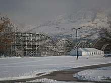
Farmington is a city in Davis County, Utah, United States. It is part of the Ogden–Clearfield, Utah Metropolitan Statistical Area. The population was 18,275 at the 2010 census[5] and was estimated at 25,339 in 2019.[6] An amusement park, called Lagoon Amusement Park, is located in Farmington.
Farmington, Utah | |
|---|---|
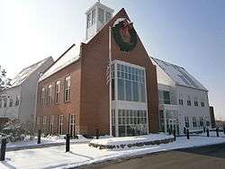
 The new City Hall, built in 2010 | |
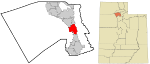
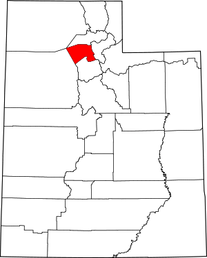
 Location in Davis County and the state of Utah | |
| Coordinates: 40°59′12″N 111°53′57″W | |
| Country | United States |
| State | Utah |
| County | Davis |
| Settled | 1847 |
| Incorporated | February 18, 1852 |
| Founded by | Hector Caleb Haight |
| Named for | Farming |
| Area | |
| • Total | 10.05 sq mi (26.02 km2) |
| • Land | 9.95 sq mi (25.78 km2) |
| • Water | 0.09 sq mi (0.24 km2) |
| Elevation | 4,304 ft (1,312 m) |
| Population (2010) | |
| • Total | 18,275 |
| • Estimate (2019)[2] | 25,339 |
| • Density | 2,545.61/sq mi (982.87/km2) |
| Time zone | UTC−7 (Mountain (MST)) |
| • Summer (DST) | UTC−6 (MDT) |
| ZIP code | 84025 |
| Area code(s) | 385, 801 |
| FIPS code | 49-24740[3] |
| GNIS feature ID | 1441004[4] |
| Website | www |
The city was ranked 12th on Money magazine's "Best Places to Live" index in 2011.[7]
History
The region that is now Farmington was settled in 1847 by the Haight family, a Mormon pioneer family, that established a farm and an inn. Five more pioneering families migrated to this region in the autumn of 1849.[8]:20 The region developed into an undefined community originally called North Cottonwood Settlement.[8]:21–22 In 1852, the territorial legislature picked North Cottonwood as the county seat and officially named it Farmington.[8]:24 Following orders from Daniel H. Wells and Brigham Young, Farmington residents built a wall around the city in 1853 under the direction of Major Thomas S. Smith. This walled townsite became known as "the Fort".[8]:26–29 Early church meetings were held in a log school and then an adobe structure. The county courthouse was used for religious meetings from 1855 to 1863. The city's ward moved back to the schoolhouse and the first meetinghouse was dedicated in January 1864.[8]:33 By the early 1860s, the town of Farmington stretched for six miles between Centerville and Kaysville.[8]:29

The Children's Primary Association of The Church of Jesus Christ of Latter-day Saints was organized here on 11 August 1878. It was the birthplace of one of the longest-lived Latter-day Saint apostles, LeGrand Richards. His maternal great-grandfather, Joseph Lee Robinson, was the first bishop of what was then the North Cottonwood Ward. Lagoon Amusement Park was founded here in 1886 and occupies 100 acres (0.40 km2) of the city. Ezra T. Clark was an early settler of Farmington who later founded the Davis County Bank and built several houses in the area, some of which are located in the Clark Lane Historic District, listed on the National Register of Historic Places.
Geography and climate
Farmington is located in east-central Davis County. It is bordered by Kaysville and Fruit Heights to the north and by Centerville to the south. The Wasatch Mountains are to the east, and the Great Salt Lake is to the west. According to the United States Census Bureau, the city has a total area of 10.0 square miles (25.8 km2), of which 9.8 square miles (25.5 km2) is land and 0.1 square miles (0.2 km2), or 0.96%, is water.[5]
Lake-enhanced snowfall occurs frequently during the winter, and cool downslope mountain breezes occur on most summer evenings. Under the Köppen climate classification, Farmington experiences what may be classified as a hot-summer Mediterranean climate (Csa), despite not being on the west coast of an ocean like most Mediterranean climates. It may also be classified as humid continental (Dsa), if the boundary between continental and subtropical climate is an average January temperature of 0 °C (32 °F) rather than −3 °C (27 °F).
| Climate data for Farmington, Utah (1981–2010) | |||||||||||||
|---|---|---|---|---|---|---|---|---|---|---|---|---|---|
| Month | Jan | Feb | Mar | Apr | May | Jun | Jul | Aug | Sep | Oct | Nov | Dec | Year |
| Average high °F (°C) | 38.1 (3.4) |
43.7 (6.5) |
54.3 (12.4) |
62.8 (17.1) |
73.2 (22.9) |
83.6 (28.7) |
92.5 (33.6) |
90.5 (32.5) |
80.0 (26.7) |
66.1 (18.9) |
50.3 (10.2) |
39.3 (4.1) |
64.5 (18.1) |
| Average low °F (°C) | 29.6 (−1.3) |
24.8 (−4.0) |
32.3 (0.2) |
39.0 (3.9) |
46.7 (8.2) |
54.7 (12.6) |
61.9 (16.6) |
60.5 (15.8) |
51.0 (10.6) |
40.0 (4.4) |
30.4 (−0.9) |
22.7 (−5.2) |
40.5 (4.7) |
| Average precipitation inches (mm) | 1.99 (51) |
2.01 (51) |
2.50 (64) |
2.44 (62) |
2.65 (67) |
1.45 (37) |
0.80 (20) |
0.69 (18) |
1.52 (39) |
2.12 (54) |
2.10 (53) |
1.97 (50) |
22.25 (565) |
| Average snowfall inches (cm) | 13.8 (35) |
11.0 (28) |
3.8 (9.7) |
1.3 (3.3) |
0.0 (0.0) |
0.0 (0.0) |
0.0 (0.0) |
0.0 (0.0) |
0.0 (0.0) |
0.3 (0.76) |
5.7 (14) |
12.7 (32) |
48.6 (123) |
| Source: NOAA[9] | |||||||||||||
Demographics
| Historical population | |||
|---|---|---|---|
| Census | Pop. | %± | |
| 1860 | 591 | — | |
| 1870 | 976 | 65.1% | |
| 1880 | 1,073 | 9.9% | |
| 1890 | 1,036 | −3.4% | |
| 1900 | 1,050 | 1.4% | |
| 1910 | 1,280 | 21.9% | |
| 1920 | 1,170 | −8.6% | |
| 1930 | 1,339 | 14.4% | |
| 1940 | 1,211 | −9.6% | |
| 1950 | 1,468 | 21.2% | |
| 1960 | 1,951 | 32.9% | |
| 1970 | 2,526 | 29.5% | |
| 1980 | 4,691 | 85.7% | |
| 1990 | 9,028 | 92.5% | |
| 2000 | 12,081 | 33.8% | |
| 2010 | 18,275 | 51.3% | |
| Est. 2019 | 25,339 | [2] | 38.7% |
| U.S. Decennial Census[10] | |||
In an 1850 census of Davis County, almost half of the Farmington residents were from New York.[8]:39 In the 2010 census[3] there were 18,275 people, 5,148 households, and 2,769 families residing in the city with an average family size of 3.41. The population density was 1,557.8 people per square mile (601.1/km2). There were 5,339 housing units at an average density of 414.7 per square mile (160.0/km2). The racial makeup of the city was 95.1% White, 0.7% African American, 0.3% Native American, 0.9% Asian, 0.3% Pacific Islander, 1.0% from other races, and 1.6% from two or more races. Hispanic or Latino of any race were 2.98% of the population.
There were 5,148 households, out of which 49% had children under the age of 18 living with them, 80.8% were married couples living together, 6.8% had a female householder with no husband present, and 10.3% were non-families. 8.3% of all households were made up of individuals, and 2.8% had someone living alone who was 65 years of age or older. The average household size was 3.72 and the average family size was 3.97.
In the city, the population was spread out, with 37.0% under the age of 18, 11.4% from 18 to 24, 27.1% from 25 to 44, 19.0% from 45 to 64, and 5.4% who were 65 years of age or older. The median age was 26 years. For every 100 females, there were 109.2 males. For every 100 females age 18 and over, there were 109.4 males.
The median income for a household in the city was $74,250, and the median income for a family was $78,492. Males had a median income of $56,847 versus $30,464 for females. The per capita income for the city was $24,407. About 1.6% of families and 2.4% of the population were below the poverty line, including 3.1% of those under age 18 and 0.2% of those age 65 or over.
S&S Shortline Railroad Park & Museum
The S&S Shortline Railroad Park & Museum, located in the Farmington area, contains over 90 pieces of railroad equipment in all shapes and sizes.[11] It also has two separate railroads where visitors can enjoy train rides on the first Saturday of every month from June to September. The track gauges of the two railroads are 2 ft (610 mm) narrow gauge[12] and 7 1⁄2 in (190.5 mm) gauge. One interesting item in the museum's collection is a 2 ft (610 mm) gauge, oil-powered, 4-4-0 steam locomotive built by Crown Metal Products.
Trail system
The Farmington Trail Committee[13] maintains 146.49 miles[14] of trail throughout the city. 36 of the trails are named that traverse from the hills on the east to the wetlands to the west. The trail system has a variety of surface material including gravel, asphalt, and concrete. There are 55 points of interest that are accessible by the trail system.[15]
Notable people
- Henry McBride, fourth governor of Washington[16]
- LeGrand Richards, religious leader
- Bruce Summerhays, Champions Tour golfer
- Daniel Summerhays, PGA Tour golfer
- Marion Jensen, Author
See also
- List of cities and towns in Utah
- Francis Peak
References
- "2019 U.S. Gazetteer Files". United States Census Bureau. Retrieved August 7, 2020.
- "Population and Housing Unit Estimates". United States Census Bureau. May 24, 2020. Retrieved May 27, 2020.
- "U.S. Census website". United States Census Bureau. Retrieved 2008-01-31.
- "US Board on Geographic Names". United States Geological Survey. 2007-10-25. Retrieved 2008-01-31.
- "Geographic Identifiers: 2010 Demographic Profile Data (G001): Farmington city, Utah". American Factfinder. U.S. Census Bureau. Archived from the original on February 13, 2020. Retrieved January 11, 2016.
- "Population and Housing Unit Estimates". Retrieved May 21, 2020.
- Best Places to Live, Money Magazine, 2009, archived from the original on 2009-10-01, retrieved 2009-10-16
- Leonard, Glen M. (1999). A History of Davis County. Salt Lake City, UT: Utah State Historical Society. ISBN 0913738433.
- "NOWData - NOAA Online Weather Data". National Oceanic and Atmospheric Administration. Retrieved May 5, 2013.
- "Census of Population and Housing". Census.gov. Retrieved June 4, 2015.
- "S & S Shortline Railroad Park & Museum". Visit Davis County, Utah. Retrieved 28 April 2015.
- Carson City & Mills Park RR No. 3
- "Trails Committee – Farmington City, Utah". www.farmington.utah.gov. Retrieved 2016-09-24.
- "Farmington Trails Information" (PDF).
- "Master Trails Map - Mountains" (PDF).
- "Washington Governor Henry McBride". National Governors Association. Retrieved October 10, 2012.
