Fairhaven Township, Carroll County, Illinois
Fairhaven Township is one of twelve townships in Carroll County, Illinois, USA. As of the 2010 census, its population was 910 and it contained 421 housing units.[2]
Fairhaven Township | |
|---|---|
 Location in Carroll County | |
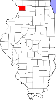 Carroll County's location in Illinois | |
| Coordinates: 41°58′54″N 89°55′38″W | |
| Country | United States |
| State | Illinois |
| County | Carroll |
| Government | |
| • Supervisor | Janice M. Queckboerner |
| Area | |
| • Total | 38.18 sq mi (98.9 km2) |
| • Land | 38.18 sq mi (98.9 km2) |
| • Water | 0 sq mi (0 km2) 0% |
| Elevation | 846 ft (258 m) |
| Population (2010) | |
| • Estimate (2016)[1] | 864 |
| • Density | 23.8/sq mi (9.2/km2) |
| Time zone | UTC-6 (CST) |
| • Summer (DST) | UTC-5 (CDT) |
| ZIP codes | 61014, 61053, 61285 |
| FIPS code | 17-015-24881 |
Geography
According to the 2010 census, the township has a total area of 38.18 square miles (98.9 km2), all land.[2]
Cities
Unincorporated towns
(This list is based on USGS data and may include former settlements.)
Cemeteries
The township contains these four cemeteries: Black Oak Lutheran, Chadwick Methodist, Fairhaven and Hope Brethren.
Major highways


School districts
- Chadwick-Milledgeville Community Unit School District 399
Political districts
- Illinois' 16th congressional district
- State House District 71
- State Senate District 36
gollark: I mean, I can manually update the pack files, but then the server won't update unless I also edit that, and then my friend won't be able to join.
gollark: I would use it but my modpack installer system requires that there be a public URL to access it.
gollark: Otherwise known as "microseconds" by sane people.
gollark: Kilonanoseconds?
gollark: kns?
References
- "Fairhaven Township, Carroll County, Illinois". Geographic Names Information System. United States Geological Survey. Retrieved 2010-01-04.
- United States Census Bureau 2007 TIGER/Line Shapefiles
- United States National Atlas
- "Population and Housing Unit Estimates". Retrieved June 9, 2017.
- "Population, Housing Units, Area, and Density: 2010 - County -- County Subdivision and Place -- 2010 Census Summary File 1". United States Census. Archived from the original on 2020-02-12. Retrieved 2013-05-28.
- "Census of Population and Housing". Census.gov. Retrieved June 4, 2016.
External links
Places adjacent to Fairhaven Township, Carroll County, Illinois | ||||||||||
|---|---|---|---|---|---|---|---|---|---|---|
| ||||||||||
Municipalities and communities of Carroll County, Illinois, United States | ||
|---|---|---|
| Cities | Map of Illinois highlighting Carroll County | |
| Villages | ||
| Townships |
| |
| Unincorporated communities | ||
| Ghost town | ||
| Footnotes | ‡This populated place also has portions in an adjacent county or counties | |
This article is issued from Wikipedia. The text is licensed under Creative Commons - Attribution - Sharealike. Additional terms may apply for the media files.