Evergreen, Missouri
Evergreen is a village in Laclede County, Missouri, United States. The population was 28 at the 2010 census.[4] It was named Twin Bridges at the 2000 census.[5]
Evergreen, Missouri | |
|---|---|
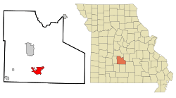 Location within the state of Missouri | |
| Coordinates: 37°32′12″N 92°35′5″W | |
| Country | United States |
| State | Missouri |
| County | Laclede |
| Area | |
| • Total | 10.21 sq mi (26.43 km2) |
| • Land | 10.11 sq mi (26.18 km2) |
| • Water | 0.10 sq mi (0.25 km2) |
| Population | |
| • Total | 28 |
| • Estimate (2019)[3] | 28 |
| • Density | 2.77/sq mi (1.07/km2) |
| Time zone | UTC-6 (Central (CST)) |
| • Summer (DST) | UTC-5 (CST) |
| FIPS code | 29-22951 |
Geography
Evergreen is located at 37°32′12″N 92°35′5″W (37.536598, -92.584594).[6]
According to the United States Census Bureau, the village has a total area of 10.21 square miles (26.44 km2), of which 10.11 square miles (26.18 km2) is land and 0.10 square miles (0.26 km2) is water.[7]
Demographics
| Historical population | |||
|---|---|---|---|
| Census | Pop. | %± | |
| 1990 | 44 | — | |
| 2000 | 42 | −4.5% | |
| 2010 | 28 | −33.3% | |
| Est. 2019 | 28 | [3] | 0.0% |
| U.S. Decennial Census[8] | |||
2010 census
As of the census[2] of 2010, there were 28 people, 10 households, and 8 families living in the village. The population density was 2.8 inhabitants per square mile (1.1/km2). There were 13 housing units at an average density of 1.3 per square mile (0.5/km2). The racial makeup of the village was 92.9% White, 3.6% African American, and 3.6% from two or more races.
There were 10 households of which 40.0% had children under the age of 18 living with them, 70.0% were married couples living together, 10.0% had a female householder with no husband present, and 20.0% were non-families. 0.0% of all households were made up of individuals. The average household size was 2.80 and the average family size was 2.75.
The median age in the village was 38.5 years. 21.4% of residents were under the age of 18; 3.6% were between the ages of 18 and 24; 28.6% were from 25 to 44; 42.8% were from 45 to 64; and 3.6% were 65 years of age or older. The gender makeup of the village was 64.3% male and 35.7% female.
2000 census
As of the census[9] of 2000, there were 42 people, 13 households, and 10 families living in the village. The population density was 4.9 people per square mile (1.9/km2). There were 16 housing units at an average density of 1.9 per square mile (0.7/km2). The racial makeup of the village was 95.24% White and 4.76% Native American. Hispanic or Latino of any race were 4.76% of the population.
There were 13 households out of which 69.2% had children under the age of 18 living with them, 69.2% were married couples living together, 7.7% had a female householder with no husband present, and 15.4% were non-families. 7.7% of all households were made up of individuals and 7.7% had someone living alone who was 65 years of age or older. The average household size was 3.23 and the average family size was 3.45.
In the village, the population was spread out with 38.1% under the age of 18, 9.5% from 18 to 24, 40.5% from 25 to 44, 9.5% from 45 to 64, and 2.4% who were 65 years of age or older. The median age was 26 years. For every 100 females, there were 121.1 males. For every 100 females age 18 and over, there were 100.0 males.
The median income for a household in the village was $31,875, and the median income for a family was $30,625. Males had a median income of $29,583 versus $13,750 for females. The per capita income for the village was $11,925. None of the population and none of the families were below the poverty line.
References
- "2019 U.S. Gazetteer Files". United States Census Bureau. Retrieved July 26, 2020.
- "U.S. Census website". United States Census Bureau. Retrieved 2012-07-08.
- "Population and Housing Unit Estimates". United States Census Bureau. May 24, 2020. Retrieved May 27, 2020.
- "Profile of General Population and Housing Characteristics: 2010 Demographic Profile Data (DP-1): Evergreen village, Missouri". United States Census Bureau. Retrieved March 6, 2012.
- "Profile of General Population and Housing Characteristics: 2000 Redistricting Data (Public Law 94-171) Summary File: Twin Bridges village, Missouri". United States Census Bureau. Retrieved March 6, 2012.
- "US Gazetteer files: 2010, 2000, and 1990". United States Census Bureau. 2011-02-12. Retrieved 2011-04-23.
- "US Gazetteer files 2010". United States Census Bureau. Archived from the original on 2012-01-25. Retrieved 2012-07-08.
- "Census of Population and Housing". Census.gov. Retrieved June 4, 2015.
- "U.S. Census website". United States Census Bureau. Retrieved 2008-01-31.
Municipalities and communities of Laclede County, Missouri, United States | ||
|---|---|---|
| Cities | 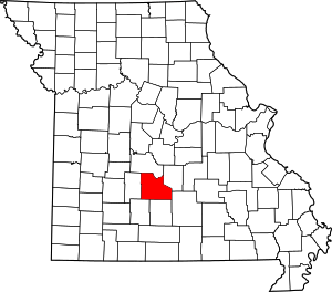 Map of Missouri highlighting Laclede County | |
| Villages | ||
| Townships |
| |
| CDP | ||
| Other unincorporated communities | ||
| Ghost towns | ||
| Footnotes | ‡This populated place also has portions in an adjacent county or counties | |