Esposende
Esposende (Portuguese pronunciation: [(ɨ)ʃpɔˈzẽd(ɨ)] (![]()
Esposende | |
|---|---|
 .jpg) 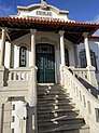  .jpg) .jpg)  | |
 Flag  Coat of arms | |
 | |
| Coordinates: 41°32′N 8°47′W | |
| Country | |
| Region | Norte |
| Intermunic. comm. | Cávado |
| District | Braga |
| Parishes | 9 |
| Government | |
| • President | Benjamim Pereira (PSD) |
| Area | |
| • Total | 95.41 km2 (36.84 sq mi) |
| Population (2011) | |
| • Total | 34,254 |
| • Density | 360/km2 (930/sq mi) |
| Time zone | UTC±00:00 (WET) |
| • Summer (DST) | UTC+01:00 (WEST) |
| Website | http://www.cm-esposende.pt/ |
Demographics
| Population of Esposende Municipality (1801–2008) | ||||||||
|---|---|---|---|---|---|---|---|---|
| 1801 | 1849 | 1900 | 1930 | 1960 | 1981 | 1991 | 2001 | 2011 |
| 4 157 | 12 545 | 15 161 | 19 452 | 23 966 | 28 652 | 30 101 | 33 325 | 34 254 |
Parishes
Administratively, the municipality is divided into nine civil parishes (freguesias):[4]
- Antas
- Apúlia e Fão
- Belinho e Mar
- Esposende, Marinhas e Gandra
- Fonte Boa e Rio Tinto
- Forjães
- Gemeses
- Palmeira de Faro e Curvos
- Vila Chã
Photos
 Cávado River in Esposende
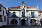
- Esposende Museum
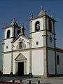 Matriz Church
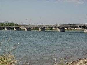 Fão Bridge
gollark: I forgot to ignore _G.
gollark: Er, basically, my sandboxing thing recursively descends the environment table to attempt to setfenv it...
gollark: Wow, I've created an amazing amount of errors so far!
gollark: Probably.
gollark: I'll try without the function environment meddlings and see.
References
- Instituto Nacional de Estatística
- "Áreas das freguesias, concelhos, distritos e país". Archived from the original on 2018-11-05. Retrieved 2018-11-05.
- UMA POPULAÇÃO QUE SE URBANIZA, Uma avaliação recente - Cidades, 2004 Archived October 6, 2014, at the Wayback Machine Nuno Pires Soares, Instituto Geográfico Português (Geographic Institute of Portugal)
- Diário da República. "Law nr. 11-A/2013, page 552 45" (pdf) (in Portuguese). Retrieved 22 July 2014.
External links

- Photos from Esposende
| Municipalities | |
|---|---|
| Museums |
|
| |
| Authority control |
|
|---|
This article is issued from Wikipedia. The text is licensed under Creative Commons - Attribution - Sharealike. Additional terms may apply for the media files.