Esher railway station
Esher railway station is a mid-priority station on the South Western Main Line operated by South Western Railway in England. The station adjoins the north of Esher with two footpaths skirting Sandown Park Racecourse, the town’s commercial area being 300 metres beyond the racecourse entrance. The station is situated between Surbiton and Hersham and is 14 miles 31 chains (23.2 km) from London Waterloo.
| Esher | |
|---|---|
 | |
| Location | |
| Place | Esher |
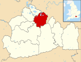
| Local authority | Elmbridge |
| Coordinates | 51.38°N 0.3526°W |
| Grid reference | TQ146658 |
| Operations | |
| Station code | ESH |
| Managed by | South Western Railway |
| Number of platforms | 4 (2 in use) |
| DfT category | C2 |
| Live arrivals/departures, station information and onward connections from National Rail Enquiries | |
| Annual rail passenger usage* | |
| 2014/15 | |
| 2015/16 | |
| 2016/17 | |
| 2017/18 | |
| 2018/19 | |
| History | |
| Key dates | Opened 21 May 1838 |
| Original company | London and Southampton Railway |
| Pre-grouping | London and South Western Railway |
| Post-grouping | Southern Railway |
| 21 May 1838 | Opened as Ditton Marsh |
| c. 1840 | Renamed Esher and Hampton Court |
| July 1844 | Renamed Esher and Claremont |
| 1 June 1913 | Renamed Esher |
| National Rail – UK railway stations | |
| * Annual estimated passenger usage based on sales of tickets in stated financial year(s) which end or originate at Esher from Office of Rail and Road statistics. Methodology may vary year on year. | |
History
The railway arrived here in 1838. A minor request stop was immediately opened and a station built and named Ditton Marsh, being the wetter part of Ditton Common. The common marks the boundary between what was then the west of Thames Ditton and Esher. The station was opened on 21 May 1838, and the name changed to Esher and Hampton Court about 1840.[1] It has since been renamed twice more: to Esher and Claremont[n 1] in July 1844, and to Esher on 1 June 1913.[2] It has also been shown as Esher for Claremont, or as Esher for Sandown Park in some timetables.[2]
Amenities
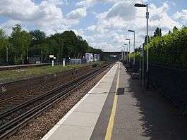
The station and track is elevated above street level[3]
A special gate on the platform opens directly onto Sandown Park racecourse.
Services
At off-peak times two trains per hour in both directions call at Esher, the termini being London Waterloo station and the larger Surrey town of Woking.
Additional trains operate during peak hours, of which at least 4 (2 in the morning rush-hour, 2 in the evening) terminate at Guildford (which also serves as the terminus for stopping trains on Sundays).[4]
Woking is the point of change for services to longer distance destinations to the south-west (see stations below).
| Preceding station | Following station | |||
|---|---|---|---|---|
| Surbiton | South Western Railway Waterloo to Woking |
Hersham | ||
Former amenities
Two additional island platforms are disused and not accessible to passengers though passed by through trains.
Bus services 515 and on Sundays 715 serve the station.
Location
The station is to the west of Weston Green which falls within the Esher postal district. Esher parish is close by the station and has included the Sandown Park grounds since its establishment in the early medieval period.[5][6][7] A footpath to the west of the station skirts Sandown Park Racecourse and leads to the Lower Green area of Esher.[8] The town’s commercial area lies 300 metres beyond the racecourse entrance, followed by West End and Claremont. The station is the closest to Esher by road.[3] Thames Ditton railway station on the branch line to Hampton Court is closest to the eastern half of Weston Green, which lies within the Thames Ditton postal district.
In film, television, fiction and the media
Esher railway station featured on an episode of the children’s TV series Little Howard's Big Question, in which the Dutch graphic and mathematical artist M. C. Escher was confused with Esher and one of his drawings mistakenly thought to be the railway station.
See also
Notes and references
- Notes
- The reference from 1844 until 1913 was to Prince Leopold's Claremont House and Landscape Garden being 1.5 miles (2.4 km) south
- References
- Butt, R.V.J. (1995). The Directory of Railway Stations. Yeovil: Patrick Stephens Ltd. p. 80. ISBN 1-85260-508-1. R508.CS1 maint: ref=harv (link)
- Butt 1995, p. 92
- OS Map with Listed Buildings and Parks marked Archived 24 April 2012 at the Wayback Machine
- Association of Train Operating Companies - official timetable
- H.E. Malden (editor) (1911). "Parishes: Esher". A History of the County of Surrey: Volume 3. Institute of Historical Research. Retrieved 11 January 2014.CS1 maint: extra text: authors list (link)
- H.E. Malden (editor) (1911) Index Map Retrieved 11 January 2014 (and see http://www.achurchnearyou.com/esher-christ-church/ for Esher parish map which confirms this unusual slight misnomer)
- Weston Green village boundaries Archived 11 January 2014 at the Wayback Machine The Church of England parish map. Retrieved 2014-01-11
- "Modern map of Lower Green Esher". Lower Green Esher. 22 November 2019. Retrieved 28 March 2020.
External links
| Wikimedia Commons has media related to Esher railway station. |
- Train times and station information for Esher railway station from National Rail
| Towns, villages and neighbourhoods |
|  | ||||||||||||||||
|---|---|---|---|---|---|---|---|---|---|---|---|---|---|---|---|---|---|---|
| Notable parks | ||||||||||||||||||
| Grade I Listed churches | ||||||||||||||||||
| Education | ||||||||||||||||||
| Transport |
| |||||||||||||||||
| Buildings and structures |
| |||||||||||||||||
| Sport | ||||||||||||||||||
Places listed are articles notable as settlements, arranged by post town The M25 motorway follows approximately a boundary and is included for its regional importance. | ||||||||||||||||||