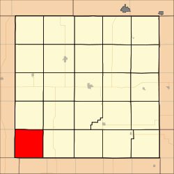
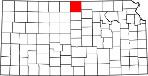
Erving Township, Jewell County, Kansas
Erving Township is a township in Jewell County, Kansas, USA. As of the 2000 census, its population was 60.
Erving Township | |
|---|---|
 Location in Jewell County | |
| Coordinates: 39°36′08″N 98°27′16″W | |
| Country | United States |
| State | Kansas |
| County | Jewell |
| Area | |
| • Total | 35.94 sq mi (93.1 km2) |
| • Land | 35.92 sq mi (93.03 km2) |
| • Water | 0.03 sq mi (0.07 km2) 0.08% |
| Elevation | 1,578 ft (481 m) |
| Population (2000) | |
| • Total | 60 |
| • Density | 1.7/sq mi (0.6/km2) |
| GNIS feature ID | 0472084 |
History
Erving Township was organized in 1872. It was named for one Dr. Erving, an early settler and native of Hiawatha.[1]
Geography
Erving Township covers an area of 35.94 square miles (93.1 square kilometers); of this, 0.03 square miles (0.07 square kilometers) or 0.08 percent is water.
Adjacent townships
- Odessa Township (north)
- Ionia Township (northeast)
- Athens Township (east)
- Cawker Township, Mitchell County (south)
- Ross Township, Osborne County (southwest)
- Lincoln Township, Smith County (west)
- Webster Township, Smith County (northwest)
Cemeteries
The township contains two cemeteries: Reformed and Rooker.
gollark: Hello, HelloBoi!
gollark: Yes, I just haven't seen any.
gollark: I mostly assume they blatantly lie about things like... the effect of policies, or what they plan to do, but not about things like the entire shape of the earth.
gollark: Although I don't know anyone doing it unironically.
gollark: It's quite easy to see that the earth flatness is wrong, unlike with religion, so I may look down on people who hold *that* belief.
References
- "1878 History of Jewell County, Kansas". Blue Skyways (State Library of Kansas). Archived from the original on 15 June 2013. Retrieved 30 December 2013.
This article is issued from Wikipedia. The text is licensed under Creative Commons - Attribution - Sharealike. Additional terms may apply for the media files.
