Dentonia, Kansas
Dentonia is a ghost town in Jewell County, Kansas, United States.[1]
Dentonia, Kansas | |
|---|---|
 KDOT map of Jewell County (legend) | |
 Dentonia  Dentonia | |
| Coordinates: 39°41′02″N 98°28′03″W | |
| Country | United States |
| State | Kansas |
| County | Jewell |
| Elevation | 1,736 ft (529 m) |
| Population | |
| • Total | 0 |
| Time zone | UTC-6 (CST) |
| • Summer (DST) | UTC-5 (CDT) |
| Area code | 785 |
| GNIS ID | 484589 [1] |
References
Further reading
External links
Municipalities and communities of Jewell County, Kansas, United States | ||
|---|---|---|
| Cities | 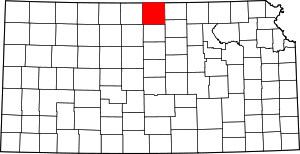 Map of Kansas highlighting Jewell County | |
| Unincorporated communities | ||
| Ghost towns | ||
| Townships | ||
This article is issued from Wikipedia. The text is licensed under Creative Commons - Attribution - Sharealike. Additional terms may apply for the media files.