Equal-area map
In map projection, equal-area maps preserve area measure, generally distorting shapes in order to do that. Equal-area maps are also called equivalent or authalic.
Several equivalent projections were developed in an attempt to minimize the distortion of countries and continents of planet Earth, keeping the area constant. Equivalent projections are widely used for thematic maps showing scenario distribution such as population, farmland distribution, forested areas, etc.
Applications
Equal area representation implies that a region of interest in a particular portion of the map will share the same proportion of area as in any other part of the map.
Statistical grid
The term "statistical grid" refers to a discrete grid (global or local) of a equal-area surface representation, used for data visualization, geocode and statistical spatial analysis.[1][2][3][4]
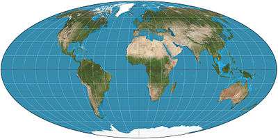
List of equal-area projections
These are some projections that preserve area:
- Albers conic
- Bonne
- Bottomley
- Collignon
- Cylindrical equal-area
- Eckert II, IV and VI
- Equal Earth
- Gall orthographic (also known as Gall–Peters, or Peters, projection)
- Goode's homolosine
- Hammer
- Hobo–Dyer
- Lambert azimuthal equal-area
- Lambert cylindrical equal-area
- Mollweide
- Sinusoidal
- Strebe 1995
- Snyder's equal-area polyhedral projection, used for geodesic grids.
- Tobler hyperelliptical
- Werner
See also
- Measure-preserving dynamical system
- Category:Equal-area projections
- Geodesic polygon area
References
- https://inspire.ec.europa.eu/forum/discussion/view/10928/use-of-the-equal-area-grid-grid-etrs89-laea
- http://scorus.org/wp-content/uploads/2012/10/2010JurmalaP4.5.pdf
- IBGE (2016), “Grade Estatística”. Arquivo
grade_estatistica.pdfem FTP ou HTTP, http://geoftp.ibge.gov.br/recortes_para_fins_estatisticos/grade_estatistica/censo_2010 - https://www.researchgate.net/publication/236852866_An_Equal_Area_Projection_for_Statistical_Mapping_in_the_EU