Enslow
Enslow is a hamlet on the banks of both the River Cherwell and the Oxford Canal in Bletchingdon civil parish, Oxfordshire.
| Enslow | |
|---|---|
The Rock of Gibraltar public house | |
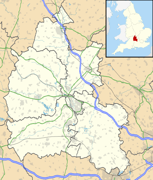
 Enslow Location within Oxfordshire | |
| OS grid reference | SP4818 |
| Civil parish | |
| District |
|
| Shire county | |
| Region | |
| Country | England |
| Sovereign state | United Kingdom |
| Post town | Kidlington |
| Postcode district | OX5 |
| Dialling code | 01869 |
| Police | Thames Valley |
| Fire | Oxfordshire |
| Ambulance | South Central |
| UK Parliament | |
| Website | Bletchingdon Parish |
The medieval main road linking London with Chipping Norton and Worcester crosses the Cherwell at Enslow.[1] There was a bridge here by the time that John Leland toured England in 1538–43.[2] John Ogilby's Britannia Atlas of 1675 records a timber bridge here that he called "Emley Bridg".[3] In 1718 the road was made into a turnpike[1] and at some stage the timber bridge was replaced by a one with pointed stone arches.[4] In 1814 the stone bridge was widened on its downstream side.[4] to almost double its former width.[1] In contrast with the older upstream side of the bridge, the 1814 arches are semicircular.[4] The road is now the A4095.
Enslow Hill, now the site of a quarry, is thought to have been identical with the Spelleburge (Old English for "Speech Hill") recorded as a traditional meeting-place for Ploughley hundred in Anglo-Saxon times.[5] The hill was the site of the unsuccessful Oxfordshire Rising of 1596 over enclosures of common land.[1] The quarry is now the site of a Cable & Wireless Communications ground station.[6]
Enslow had a water mill that was recorded in 1086 in the Domesday Book, and again in 1340 and in the 17th and 18th centuries.[1] The arrival of the Oxford Canal led to the building of a wharf and associated buildings in 1788.[1] Early in the 19th century the Rock of Gibraltar public house[7] was built to serve the trade on and around the wharf.
From 1845 the Oxford and Rugby Railway ran through the hamlet and in 1850 Bletchington railway station was built.[8] British Railways closed the station in 1964 but the line remains open as part of the Cherwell Valley Line.
References
- Lobel 1959, pp. 56–71
- Jervoise 1932, p. 153.
- Jervoise 1932, pp. 153–154.
- Jervoise 1932, p. 154.
- Lobel 1959, pp. 1–6.
- "Mercury satellite communications ground station". Science photo. Archived from the original on 21 October 2015. Retrieved 14 September 2014.
- The Rock of Gibraltar
- MacDermot 1927, p. 300.
Sources
- Jervoise, Edwyn (1932). The Ancient Bridges of Mid and Eastern England. III. Westminster: The Architectural Press for the SPAB. pp. 153–154.CS1 maint: ref=harv (link)
- Lobel, Mary D, ed. (1959). "Bletchingdon". A History of the County of Oxford. Victoria County History. 6. pp. 56–71.CS1 maint: ref=harv (link)
- MacDermot, Edward T. (1927). History of the Great Western Railway. I: 1833–1863. London: Great Western Railway. p. 300.CS1 maint: ref=harv (link)
