Empalme Olmos
Empalme Olmos is a village in the Canelones Department of southern Uruguay.
Empalme Olmos | |
|---|---|
Village | |
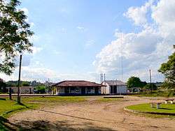 Train station at Empalme Olmos | |
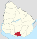
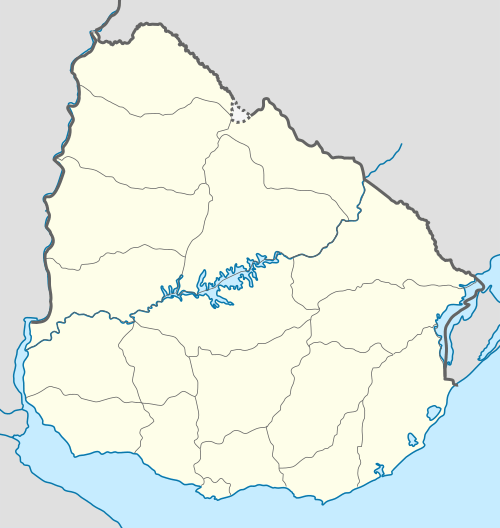 Empalme Olmos Location in Uruguay | |
| Coordinates: 34°42′0″S 55°54′0″W | |
| Country | |
| Department | Canelones Department |
| Population (2011) | |
| • Total | 4,199 |
| Time zone | UTC -3 |
| Postal code | 91002 |
| Dial plan | +598 2 (+7 digits) |
Empalme Olmos is also the name of the municipality to which the town belongs.
Location
The village is located at the junction of Route 8 with Routes 82 and 34, about 6 kilometres (3.7 mi) northeast of the city of Pando.
History
Its status was elevated to "Pueblo" (village) on 3 November 1952 by the Act of Ley Nº 11.877.[1]
Population
In 2011 Empalme Olmos had a population of 4,199.[2] In 2010, the Intendencia de Canelones had recorded a population of 5,497 for the municipality during the elections.[3]
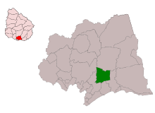
Location map of the Municipality of Empalme Olmos
| Year | Population |
|---|---|
| 1963 | 1,973 |
| 1975 | 2,108 |
| 1985 | 3,144 |
| 1996 | 3,815 |
| 2004 | 3,978 |
| 2011 | 4,199 |
Source: Instituto Nacional de Estadística de Uruguay[4]
Places of worship
- St. Rose of Lima Parish Church (Roman Catholic)
gollark: And it does hurt to (threaten to, not sure how credible it is) take someone's job over not "clarifying".
gollark: The link has "kspalaiologos" in it.
gollark: Well, not "at most".
gollark: It's only every week or so, and 30 minutes (total) at most.
gollark: That's not accurate.
References
- "LEY N° 11.877". República Oriental del Uruguay, Poder Legislativo. 1952. Archived from the original on 4 March 2016. Retrieved 7 September 2012.
- "Censos 2011 Cuadros Canelones". INE. 2012. Archived from the original on 10 October 2012. Retrieved 25 August 2012.
- "Elecciones - Canelones". El Observador. Archived from the original on 12 March 2012. Retrieved 2 February 2012.
- "Statistics of urban localities (1963–2004)" (PDF). INE. 2012. Archived from the original (PDF) on 5 November 2012. Retrieved 7 September 2012.
Images
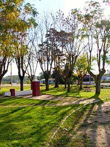
Plaza 30 de noviembre near the train station at Empalme Olmos.
External links
| Wikimedia Commons has media related to Empalme Olmos. |
Capital: Canelones | ||
| Towns and villages |
|  |
| Resorts of the Ciudad de la Costa | ||
| Sights |
| |
This article is issued from Wikipedia. The text is licensed under Creative Commons - Attribution - Sharealike. Additional terms may apply for the media files.