Elkhart Township, Elkhart County, Indiana
Elkhart Township is one of sixteen townships in Elkhart County, Indiana. As of the 2010 census, its population was 36,487.[3]
Elkhart Township | |
|---|---|
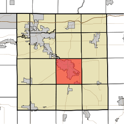 Location of Elkhart Township in Elkhart County | |
| Coordinates: 41°33′59″N 85°49′41″W | |
| Country | United States |
| State | Indiana |
| County | Elkhart |
| Government | |
| • Type | Indiana township |
| Area | |
| • Total | 35.69 sq mi (92.4 km2) |
| • Land | 35.04 sq mi (90.8 km2) |
| • Water | 0.65 sq mi (1.7 km2) |
| Elevation | 804 ft (245 m) |
| Population (2010) | |
| • Total | 36,487 |
| • Density | 1,041.2/sq mi (402.0/km2) |
| FIPS code | 18-20746[2] |
| GNIS feature ID | 453275 |
History
The Dierdorff Farmstead was listed on the National Register of Historic Places in 2011.[4]
Geography
According to the 2010 census, the township has a total area of 35.69 square miles (92.4 km2), of which 35.04 square miles (90.8 km2) (or 98.18%) is land and 0.65 square miles (1.7 km2) (or 1.82%) is water.[3]
Cities and towns
- Goshen (vast majority)
Unincorporated towns
Adjacent townships
- Jefferson Township (north)
- Middlebury Township (northeast)
- Clinton Township (east)
- Benton Township (southeast)
- Jackson Township (south)
- Union Township (southwest)
- Harrison Township (west)
- Concord Township (northwest)
Cemeteries
The township contains seven cemeteries: Cripe, Elkhart Prairie, Hess, Oak Ridge, Sparklin, Studebaker and Violett.
Education
Elkhart Township residents may obtain a library card at the Goshen Public Library in Goshen.[5]
gollark: I WILL be candidate. There is no escape.
gollark: pig undergo immediate apification
gollark: This REALLY should not be required and I don't know why it is.
gollark: ++magic reload_ext irc_link
gollark: It seems to be a server/power/network failure.
References
- "Elkhart Township, Elkhart County, Indiana". Geographic Names Information System. United States Geological Survey. Retrieved 2009-09-24.
- United States Census Bureau cartographic boundary files
- "US Board on Geographic Names". United States Geological Survey. 2007-10-25. Retrieved 2008-01-31.
- "U.S. Census website". United States Census Bureau. Retrieved 2008-01-31.
- "Population, Housing Units, Area, and Density: 2010 - County -- County Subdivision and Place -- 2010 Census Summary File 1". United States Census. Archived from the original on 2020-02-12. Retrieved 2013-05-10.
- "National Register of Historic Places Listings". Weekly List of Actions Taken on Properties: 3/21/11 through 3/25/11. National Park Service. 2011-04-01.
- "About us". Goshen Public Library. Retrieved 7 March 2018.
External links
Municipalities and communities of Elkhart County, Indiana, United States | ||
|---|---|---|
| Cities | Map of Indiana highlighting Elkhart County | |
| Towns | ||
| Townships | ||
| CDPs | ||
| Unincorporated communities | ||
| Footnotes | ‡This populated place also has portions in an adjacent county or counties | |
| Authority control |
|
|---|
This article is issued from Wikipedia. The text is licensed under Creative Commons - Attribution - Sharealike. Additional terms may apply for the media files.