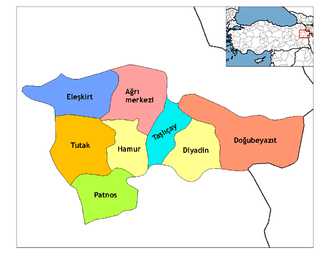
Eleşkirt
Eleşkirt (Kurdish: Zêdikan)[3] is a town and district of Ağrı Province in Turkey. Its name is a transference from Alashkert (Armenian: Ալաշկերտ Alaškert), the valley's former administrative centre but now a village known as Toprakkale. At the time of the Russo-Turkish War of 1877-1878 approximately half of the population consisted of Armenians and the rest of Kurds and Turks.[4]
Eleşkirt | |
|---|---|
%2C_Agir%C3%AE.jpg) General view of Eleşkirt | |
 Eleşkirt | |
| Coordinates: 39°47′53″N 42°40′28″E | |
| Country | |
| Province | Ağrı |
| Government | |
| • Mayor | Ramazan Yakut (Felicity Party) |
| Area | |
| • District | 1,545.18 km2 (596.60 sq mi) |
| Population (2012)[2] | |
| • Urban | 11,247 |
| • District | 39,040 |
| • District density | 25/km2 (65/sq mi) |
| Website | www.eleskirt.bel.tr |
The mayor is Ramazan Yakut (Felicity Party).[5]
Places to see
Eleşkirt is a small town on a plain surrounded by high mountains, that has been occupied since the kingdom of the Urartu, as can be seen from:
- A burial mound (höyük) in the village of Pirabat
- The castle in the village of Toprakkale (ku:Kelê). In antiquity the district was ruled from the castle which was successively occupied by Romans, Persians, Armenians, Arabs, Greek Byzantines, Seljuk Turks, Mongols and then further waves of Turks. There is a mosque which was built in 1687 in this village.
- There is a mountain named Kösedağ near the town. It is popular for climbing.[6] Actually a lot of tourists come to see and climb this mountain from different countries every year.
Kösedag as a surname has been used by many generations of people, such as the Seqeto family. Their biggest son, Murat (Deliyürek) Muratoglu, Hirsiz Meliko, Fatih Culeg, Adoye Ker and Aytacoye Spigwer are several examples of this big dynasty.
References
- "Area of regions (including lakes), km²". Regional Statistics Database. Turkish Statistical Institute. 2002. Retrieved 2013-03-05.
- "Population of province/district centers and towns/villages by districts - 2012". Address Based Population Registration System (ABPRS) Database. Turkish Statistical Institute. Retrieved 2013-02-27.
- Adem Avcıkıran (2009). Kürtçe Anamnez Anamneza bi Kurmancî (PDF) (in Turkish and Kurdish). p. 56. Retrieved 17 December 2019.
- Zatikyan, Hovhannes [Զատիկյան, Հովհաննես] Noravank, 2013, "Garin province in the second half of the nineteenth century" [ Կարինի նահանգը XIX դարի երկրորդ կեսին] pp. 391, 402 url = http://www.noravank.am/upload/pdf/KARINI_NAHANGY.pdf
- "Ağrı Eleşkirt Seçim Sonuçları - 31 Mart 2019 Yerel Seçimleri". www.sabah.com.tr. Retrieved 2019-09-09.
- "Köse Dağı & Küçük Kösedağ – Spectacular Mountains". Retrieved 2019-09-09.
