Eiði
Eiði [ˈaiːjɪ] (![]()
- For gifts given by Muslims on the day of Eid, see Eidi (gift).
Eiði Ejde | |
|---|---|
Village | |
Eiði | |
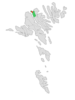
 Location of Eiði within Eiði municipality in the Faroe Islands | |
 Eiði Location of Eiði village in the Faroe Islands | |
| Coordinates: 62°17′57″N 7°5′25″W | |
| State | |
| Constituent country | |
| Island | Eysturoy |
| Municipality | Eiði |
| Population (2016) | |
| • Total | 669 |
| Time zone | GMT |
| • Summer (DST) | UTC+1 (EST) |
| Zip | FO 470 |
| Climate | Cfc |
Its name means isthmus in the Faroese language. The town has a population of Approx. 670 inhabitants. Eiði was first mentioned in writing, early in the 14th Century. Carbon dating indicated that the village, was settled by Vikings in the 9th century AD. In the center of the village there is a large stone church built in 1881. until 1894, the village was part of the Eysturoy Region. in 1879 local people wrote to the national government, requesting to become an independent municipality. This request started the long and drawn out process, of creating the municipality. By the autumn of 1894 the 5 villages of Eiði, Svínáir, Ljósá, Oyri and Norðskáli elected to form an independent municipality with the main village being Eiði. Eiði housed the seat of the local government. The first mayor was Gregers Joensen, additionally he was the first educated teacher of The Faroe Islands receiving his diploma from the Faroese Teachers School in 1871, and serving as the local teacher from 1871 until his death on 12 June 1897 at the age of 61.
in 1943 The villages of Norðskáli, Oyri and Svínáir requested to opt out of the municipality. At the municipal meeting, a majority voted for Norðskáli and Oyri leaving the municipality, However Svínáir eventually decided against leaving. Thusly, the modern municipality of Eiði contains the villages of Eiði, Ljósá and Svínáir
Sports
The village's football team is EB/Streymur. It was founded 1993 as a merger between Eiðis Bóltfelag and Ítróttarfelagið Streymur.
Geography
Within walking distance of Eiði is the 343-meter-high promontory Eiðiskollur, from the top of which a beautiful view can be had over the sea and the islands, including a view down onto Risin og Kellingin, two legendary rocks that rise 75 meters up from the sea.
A couple of kilometers southeast of Eiði is Lake Eiði, a dammed lake. The water from the dam supplies the 21 MW Eiði hydroelectric power station below. At Eiði, there is a LORAN-C station. The mast of the facility may be the tallest structure on the Faroe Islands. The mast was removed in 2019 after it was deemed obsolete.
See also
- List of towns in the Faroe Islands
External links

- Faroeislands.dk: Eiði Images and description of all cities on the Faroe Islands
- eiði.com Local link collection
- Municipality of Eiði
