East Honolulu, Hawaii
East Honolulu is a census-designated place (CDP) located in Honolulu County, Hawaii, United States. As of the 2010 Census, the CDP had a population of 49,914, making it the 2nd most populated CDP in Hawaii, behind Honolulu.[2]
East Honolulu | |
|---|---|
 | |
| Coordinates: 21°17′20″N 157°43′2″W | |
| Country | |
| State | |
| Counties | |
| Area | |
| • Total | 3.4 sq mi (8.9 km2) |
| • Land | 2.3 sq mi (6.0 km2) |
| • Water | 1.2 sq mi (3.0 km2) |
| Population (2010) | |
| • Total | 49,914 |
| Time zone | UTC-10 |
| Area code(s) | 808 |
| GNIS feature ID | 2583416[1] |
Geography
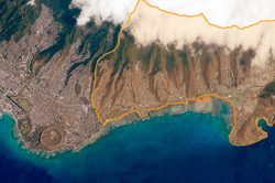
East Honolulu is centered on 21°17′20″N 157°43′2″W (21.2891, -157.7173). According to the United States Census Bureau, the CDP has a total area of 3.4 square miles (8.9 km2), of which 2.3 square miles (6.0 km2) is land and 1.2 square miles (3.0 km2), or 33.22%, is water.[3]
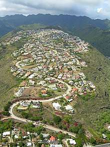
Puuikena Drive in East Honolulu
East Honolulu consists of the area directly east of the center of Honolulu, beginning at the Wai'alae Country Club and extending east to Makapu'u Point, the easternmost point on the island of Oahu. It consists of mostly upscale neighborhoods.
gollark: Ah, but he's *nicknamed* that.
gollark: So pjals and pjals3.
gollark: Well, nobody is called "pjals" right now...
gollark: * two more
gollark: If only I had two accounts so I could be pjals2 and pjals3.
References
- "East Honolulu Census Designated Place". Geographic Names Information System. United States Geological Survey. Retrieved December 29, 2013.
- "Profile of General Population and Housing Characteristics: 2010 Demographic Profile Data (DP-1): East Honolulu CDP, Hawaii". United States Census Bureau. Retrieved May 17, 2012.
- "Geographic Identifiers: 2010 Demographic Profile Data (G001): East Honolulu CDP, Hawaii". United States Census Bureau. Retrieved May 17, 2012.
Islands, municipalities, and communities of Honolulu County, Hawaii, United States | ||
|---|---|---|
| CDPs |
| 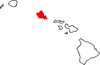 Map of Hawaii highlighting Honolulu County |
| Other communities |
| |
This article is issued from Wikipedia. The text is licensed under Creative Commons - Attribution - Sharealike. Additional terms may apply for the media files.