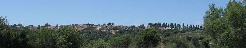
Dovev
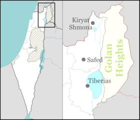
Dovev (Hebrew: דּוֹבֵ"ב) is a moshav in northern Israel. Located in the Upper Galilee around 7 km north of Har Meron near Israel's border with Lebanon, it falls under the jurisdiction of Merom HaGalil Regional Council. In 2019 it had a population of 483.[1]
Dovev דּוֹבֵ"ב | |
|---|---|
 Dovev | |
| Coordinates: 33°3′7.91″N 35°24′27.36″E | |
| Country | Israel |
| District | Northern |
| Council | Merom HaGalil |
| Affiliation | Moshavim Movement |
| Founded | 1963 |
| Founded by | Moroccan and Iranian Jewish immigrants |
| Population (2019)[1] | 483 |
History
The moshav was founded in 1963 by immigrants and refugees to Israel from Morocco and Iran on the land of the depopulated Palestinian Arab village of Kafr Bir'im, northwest of the village site.[2] It was named after David Bloch-Blumenfeld (Dovev is an acronym of his initials), one of the leaders of the Labor Movement in the land of Israel, who was a mayor of Tel Aviv. East of the moshav is a nature reserve, the pond of Dovev.[3]
Most residents of Dovev were evacuated due to safety concerns during the 1982 Lebanon War and again in Operation Grapes of Wrath in 1996. In 2006, four Katyusha rockets landed on the outskirts of the moshav, damaging fruit trees.[4]
See also
- Baram National Park
References
- "Population in the Localities 2019" (XLS). Israel Central Bureau of Statistics. Retrieved 16 August 2020.
- Khalidi, Walid (1992), All That Remains: The Palestinian Villages Occupied and Depopulated by Israel in 1948, Washington D.C.: Institute for Palestine Studies, ISBN 0-88728-224-5, p.461
- Mapa's Concise Gazetteer of Israel (in Hebrew). Yuval El'azari (ed.). Tel Aviv, Israel: Mapa Publishing. 2005. p. 126. ISBN 965-7184-34-7.CS1 maint: others (link)
- Izenberg, Dan (July 20, 2006). "Moshav Avivim still stands determined during tensions". The Jerusalem Post. Retrieved May 1, 2019.