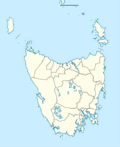
Dover, Tasmania
Dover is the southernmost town of its size in Australia, located on the western shores towards the southern end of the D'Entrecasteaux Channel, just south of the Huon Valley, southwest of Hobart, located on the head of Port Esperance in Tasmania. With a population of 486, 91% of the population was born in Australia and 5% was born in United Kingdom as well as other less common nationalities such as New Zealand, Germany and Greece all clustering around the 1% mark.[3]
| Dover Tasmania | |||||||||
|---|---|---|---|---|---|---|---|---|---|
 Dover | |||||||||
| Coordinates | 43°18′S 147°1′E | ||||||||
| Population | 486 (2016 census)[1] | ||||||||
| Postcode(s) | 7117 | ||||||||
| Elevation | 17 m (56 ft)[2] | ||||||||
| LGA(s) | Huon Valley Council | ||||||||
| State electorate(s) | Franklin | ||||||||
| Federal Division(s) | Franklin | ||||||||
| |||||||||
Etymology
First recorded in its Latinised form of Portus Dubris, the name derives from the Brythonic word for waters (dwfr in Middle Welsh). The same element is present in the towns French (Douvres) and Modern Welsh (Dofr) forms.
History
The place name of Blubber Head, at the northern entrance to Port Esperance, may indicate shore-based bay whaling activity took place at the location in the 19th century.[4]
Port Esperance Post Office opened on 6 February 1856 and was renamed Dover in 1895[5]
In 2013, the Dover Hotel pub/tavern was destroyed when it was engulfed by a fire. (https://www.abc.net.au/news/2013-04-17/fire-engulfs-dover-hotel/4634064)
Climate
Dover has a marine climate with consistently cool, cloudy weather all year round. Despite its southerly latitude and low maximum temperatures, snow and frost are uncommon in winter, however sleet is an occasional occurrence. The hottest temperature ever recorded in Dover was 39.6 °C (103.3 °F), almost 20 °C above the January monthly average.
| Climate data for Dover (1901-2013) | |||||||||||||
|---|---|---|---|---|---|---|---|---|---|---|---|---|---|
| Month | Jan | Feb | Mar | Apr | May | Jun | Jul | Aug | Sep | Oct | Nov | Dec | Year |
| Record high °C (°F) | 39.6 (103.3) |
36.8 (98.2) |
37.0 (98.6) |
28.6 (83.5) |
25.2 (77.4) |
18.9 (66.0) |
18.5 (65.3) |
22.6 (72.7) |
26.7 (80.1) |
31.9 (89.4) |
34.2 (93.6) |
37.3 (99.1) |
39.6 (103.3) |
| Average high °C (°F) | 20.7 (69.3) |
20.6 (69.1) |
19.2 (66.6) |
16.8 (62.2) |
14.7 (58.5) |
12.5 (54.5) |
12.3 (54.1) |
13.1 (55.6) |
14.6 (58.3) |
16.1 (61.0) |
17.6 (63.7) |
19.1 (66.4) |
16.4 (61.5) |
| Average low °C (°F) | 10.2 (50.4) |
10.2 (50.4) |
9.0 (48.2) |
7.1 (44.8) |
5.8 (42.4) |
3.8 (38.8) |
3.5 (38.3) |
4.1 (39.4) |
4.9 (40.8) |
6.4 (43.5) |
7.8 (46.0) |
8.9 (48.0) |
6.8 (44.2) |
| Record low °C (°F) | 3.1 (37.6) |
2.6 (36.7) |
1.9 (35.4) |
−2.0 (28.4) |
−1.5 (29.3) |
−2.0 (28.4) |
−3.4 (25.9) |
−1.8 (28.8) |
−2.1 (28.2) |
−0.5 (31.1) |
0.9 (33.6) |
1.2 (34.2) |
−3.4 (25.9) |
| Average precipitation mm (inches) | 52.8 (2.08) |
51.9 (2.04) |
63.8 (2.51) |
67.3 (2.65) |
71.0 (2.80) |
78.8 (3.10) |
85.1 (3.35) |
89.7 (3.53) |
84.1 (3.31) |
85.9 (3.38) |
71.7 (2.82) |
71.4 (2.81) |
875.7 (34.48) |
| Average rainy days (≥ 0.2mm) | 11.6 | 10.5 | 12.8 | 14.2 | 15.6 | 15.6 | 18.6 | 17.7 | 17.1 | 17.3 | 15.3 | 14.1 | 180.4 |
| Average relative humidity (%) | 59 | 60 | 61 | 66 | 69 | 73 | 71 | 66 | 63 | 62 | 62 | 59 | 64 |
| Source: [6] | |||||||||||||
References
- Australian Bureau of Statistics (27 June 2017). "Dover". 2016 Census QuickStats. Retrieved 22 January 2018.

- "Dover". Daily rainfall. Bureau of Meteorology. Retrieved 29 December 2009.
- http://www.domain.com.au/Public/SuburbProfile.aspx?searchTerm=Dover&mode=research%5B%5D
- Kathryn Evans, Shore-based whaling in Tasmania: historical research project; Volume 2; site histories, Tasmanian Parks and Wildlife Service, Hobart, 1993, p.40.
- Premier Postal History. "Post Office List". Premier Postal Auctions. Retrieved 16 June 2012.
- "Climate statistics for Dover". Bureau of Meteorology. Retrieved 10 May 2013.