Difficult, Tennessee
Difficult is an unincorporated community in Smith County, Tennessee, in the United States.[1] It lies just north of State Route 85, about halfway between Defeated to the south and Kempville to the east. Defeated Creek, a tributary of the Cumberland River, passes through the community.
Difficult, Tennessee | |
|---|---|
Unincorporated community | |
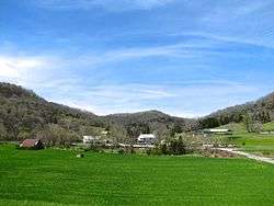 Buildings and houses in Difficult | |
 Difficult, Tennessee  Difficult, Tennessee | |
| Coordinates: 36°22′09″N 85°53′32″W | |
| Country | United States |
| State | Tennessee |
| County | Smith |
| Elevation | 538 ft (164 m) |
| Time zone | UTC-6 (Central (CST)) |
| • Summer (DST) | UTC-5 (CDT) |
| ZIP code | 37145 |
| Area code(s) | 615 |
| GNIS feature ID | 1306346[1] |
History
One version of the name's origin holds that when residents applied for a post office, the application was returned because the preferred name was "too difficult".[2][3][4]
gollark: ++potatOS
gollark: =tex \frac{\left( x-2\right)\cdot-1}{6}\cdot\left( x-3\right)\cdot\left( x-4\right)+2\cdot\left( x-1\right)\cdot\left( x-3\right)\cdot\left( x-4\right)+\frac{\left( x-1\right)\cdot-9}{2}\cdot\left( x-2\right)\cdot\left( x-4\right)+\frac{\left( x-1\right)\cdot8}{3}\cdot\left( x-2\right)\cdot\left( x-3\right)
gollark: =tex \frac{\left( x-2\right)\cdot-1}{6}\cdot\left( x-3\right)\cdot\left( x-4\right)+2\cdot\left( x-1\right)\cdot\left( x-3\right)\cdot\left( x-4\right)+\frac{\left( x-1\right)\cdot-9}{2}\cdot\left( x-2\right)\cdot\left( x-4\right)+\frac{\left( x-1\right)\cdot8}{3}\cdot\left( x-2\right)\cdot\left( x-3\right)
gollark: ++potatOS
gollark: =tex \frac{\left( x-2\right)\cdot-1}{6}\cdot\left( x-3\right)\cdot\left( x-4\right)+2\cdot\left( x-1\right)\cdot\left( x-3\right)\cdot\left( x-4\right)+\frac{\left( x-1\right)\cdot-9}{2}\cdot\left( x-2\right)\cdot\left( x-4\right)+\frac{\left( x-1\right)\cdot8}{3}\cdot\left( x-2\right)\cdot\left( x-3\right)
References
- U.S. Geological Survey Geographic Names Information System: Difficult, Tennessee
- Miller, Larry L. (2001). Tennessee Place-names. Indiana University Press. p. 62. ISBN 0-253-21478-5.
- Kennedy, Mark (Feb 19, 1989). "Speck-on-the-map towns in Tennessee". Herald-Journal. pp. C13. Retrieved 18 August 2015.
- Moyer, Armond; Moyer, Winifred (1958). The origins of unusual place-names. Keystone Pub. Associates. p. 34.
External links

Municipalities and communities of Smith County, Tennessee, United States | ||
|---|---|---|
| Towns | ||
| Unincorporated communities | ||
This article is issued from Wikipedia. The text is licensed under Creative Commons - Attribution - Sharealike. Additional terms may apply for the media files.