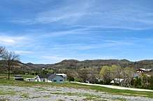
Tennessee State Route 85
State Route 85 (SR 85) is an east-west state highway in Middle Tennessee. The 85.24 miles (137.18 km)-long road traverses portions of Smith, Jackson, Overton, and Fentress Counties. [1][2]
| ||||
|---|---|---|---|---|
| Route information | ||||
| Maintained by TDOT | ||||
| Length | 85.24 mi (137.18 km) | |||
| Major junctions | ||||
| West end | ||||
| East end | ||||
| Location | ||||
| Counties | Smith, Jackson, Overton, Fentress | |||
| Highway system | ||||
| ||||


Route Description
Smith County
SR 85 begins in Smith County in Monoville at a junction with SR 80. It goes east as a primary highway to an intersection with SR 263 before passing by Cordell Hull Lake/Cumberland River. It then passes through Defeated and travels along Defeated Creek for a short distance before turning east again and passing through Kempville.
Jackson County
SR 85 then enters Jackson County and passes by the historic home of Sampson Williams. It then climbs a few mountains before coming to a junction and becomes concurrent with SR 262 at a crossing of an arm of Cordell Hull Lake. They then parallel the Cumberland River until SR 85 separates from SR 262 and turns north. SR 85 then becomes a very curvy secondary highway and turns northeast as it climbs through some more mountains for several miles. It then intersects SR 56/SR 135 in Jennings Creek and joins their concurrency, becoming primary once again. They then turn south and pass by Jackson County Middle School before crossing the Cumberland River again and intersecting with SR 53 just north of Gainesboro. SR 56 turns south along SR 53 while SR 85 and SR 135 turn north along SR 53. The three travel along the banks of the Cumberland River before they all split at a W-shaped intersection, with SR 53 turning north along the Cumberland, SR 135 goes southeast, and SR 85 east, leaving the Cumberland River for the final time. SR 85 then goes through some more mountains before passing through Burristown and some farmland. It then becomes curvy again and crosses into Overton County.
Overton County
It then enters Hillham and intersects SR 136. SR 85 then curves to the southeast and leaves Hilham, passing by Hilham School. It the continues east to intersect SR 84 before entering Livingston. It the intersects and becomes concurrent with SR 111 for a short distance before entering downtown. In downtown, SR 85 intersects and becomes concurrent with SR 52. They then leave downtown and intersect SR 294 before leaving Livingston. SR 52/SR 85 then become curvy and pass through Alpine. SR 52 then separates and turns north, while SR 85 turns south, becoming secondary once again. It then passes through Allred it then becomes extremely curvy and climbs a very large mountain to junction with SR 164 north of Crawford. It stays curvy for several more miles to pass through Twinton, where it meets Craventown Road, which to the Wilder community just to the north, before the road crosses into Fentress County.
Fentress County
SR 85 then goes through Davidson (where it passes by the Wilder post office) and some hairpin turns before the road finally straightens out as it enters farmland, coming to an end shortly thereafter at US 127/SR 28 between Clarkrange and Grimsley beside South Fentress Elementary School.
Major intersections[2]
| County | Location | mi | km | Destinations | Notes |
|---|---|---|---|---|---|
| Smith | Monoville | 0.00 | 0.00 | Western terminus; begins as a primary highway | |
| | Northern terminus of SR 263 | ||||
| Jackson | | Western end of SR 262 concurrency | |||
| | Eastern end of SR 262 concurrency; SR 85 becomes secondary route | ||||
| | Western end of concurrency with SR 56 and SR 135 | ||||
| | Gainesboro bridge over Cumberland River | ||||
| Gainesboro | Eastern end of SR 56 concurrency; Western end of SR 53 concurrency; SR 85 becomes a primary route | ||||
| Eastern end of SR 135 concurrency | |||||
| Eastern end of SR 53 concurrency | |||||
| Overton | Hilham | ||||
| | Northern terminus of SR 84 | ||||
| Livingston | Western end of SR 111 concurrency | ||||
| Eastern end of SR 111 concurrency | |||||
| Western end of SR 52 concurrency | |||||
| Southern terminus of SR 294 | |||||
| Alpine | Eastern end of SR 52 concurrency; SR 85 becomes a secondary route | ||||
| Crawford | Northern terminus of SR 164 | ||||
| Fentress | Grimsley | 85.24 | 137.18 | Eastern terminus; SR 85 ends as a secondary highway | |
1.000 mi = 1.609 km; 1.000 km = 0.621 mi
| |||||
See also
References
- Microsoft MapPoint 2006, Retrieved on 2007-8-13
- Tennessee Atlas & Gazetteer (Map) (2010 ed.). DeLorme.