Denver, Indiana
Denver is a town in Jefferson Township, Miami County, in the U.S. state of Indiana.[6] The population was 482 at the 2010 census.
Denver, Indiana | |
|---|---|
| Town of Denver | |
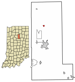 Location of Denver in Miami County, Indiana. | |
| Coordinates: 40°51′55″N 86°4′40″W | |
| Country | United States |
| State | Indiana |
| County | Miami |
| Township | Jefferson |
| Area | |
| • Total | 0.24 sq mi (0.62 km2) |
| • Land | 0.24 sq mi (0.62 km2) |
| • Water | 0.00 sq mi (0.00 km2) |
| Elevation | 709 ft (216 m) |
| Population | |
| • Total | 482 |
| • Estimate (2019)[4] | 467 |
| • Density | 1,945.83/sq mi (751.56/km2) |
| Time zone | UTC-5 (Eastern (EST)) |
| • Summer (DST) | UTC-5 (EST) |
| ZIP code | 46926 |
| Area code(s) | 765 |
| FIPS code | 18-17776[5] |
| GNIS feature ID | 433483 |
Denver is served by North Miami Schools.
History
Denver was laid out in 1872 when the Eel River Railroad was extended to that point.[7][8] The town was named after Denver, Colorado.[9] The post office at Denver has been in operation since 1869.[10]
Geography
Denver is located at 40°51′55″N 86°4′40″W (40.865277, -86.077746).[11]
According to the 2010 census, Denver has a total area of 3.61 square miles (9.35 km2), all land.[12]
Demographics
| Historical population | |||
|---|---|---|---|
| Census | Pop. | %± | |
| 1880 | 273 | — | |
| 1920 | 522 | — | |
| 1930 | 472 | −9.6% | |
| 1940 | 483 | 2.3% | |
| 1950 | 528 | 9.3% | |
| 1960 | 565 | 7.0% | |
| 1970 | 566 | 0.2% | |
| 1980 | 589 | 4.1% | |
| 1990 | 504 | −14.4% | |
| 2000 | 541 | 7.3% | |
| 2010 | 482 | −10.9% | |
| Est. 2019 | 467 | [4] | −3.1% |
| U.S. Decennial Census[13] | |||
2010 census
As of the census[3] of 2010, there were 482 people, 177 households, and 133 families living in the town. The population density was 2,095.7 inhabitants per square mile (809.2/km2). There were 194 housing units at an average density of 843.5 per square mile (325.7/km2). The racial makeup of the town was 98.8% White, 0.2% African American, 0.6% Native American, and 0.4% from two or more races. Hispanic or Latino of any race were 1.2% of the population.
There were 177 households, of which 41.2% had children under the age of 18 living with them, 57.1% were married couples living together, 11.9% had a female householder with no husband present, 6.2% had a male householder with no wife present, and 24.9% were non-families. 20.3% of all households were made up of individuals, and 11.3% had someone living alone who was 65 years of age or older. The average household size was 2.72 and the average family size was 3.13.
The median age in the town was 37.6 years. 29.3% of residents were under the age of 18; 5.3% were between the ages of 18 and 24; 27.4% were from 25 to 44; 25.3% were from 45 to 64; and 12.7% were 65 years of age or older. The gender makeup of the town was 48.5% male and 51.5% female.
2000 census
As of the census[5] of 2000, there were 541 people, 189 households, and 158 families living in the town. The population density was 2,318.0 people per square mile (908.2/km2). There were 200 housing units at an average density of 856.9 per square mile (335.7/km2). The racial makeup of the town was 98.89% White, 0.55% Native American, and 0.55% from two or more races. Hispanic or Latino of any race were 0.37% of the population.
There were 189 households, out of which 48.7% had children under the age of 18 living with them, 64.0% were married couples living together, 16.9% had a female householder with no husband present, and 15.9% were non-families. 13.8% of all households were made up of individuals, and 6.3% had someone living alone who was 65 years of age or older. The average household size was 2.86 and the average family size was 3.11.
In the town, the population was spread out, with 30.9% under the age of 18, 6.8% from 18 to 24, 34.2% from 25 to 44, 18.5% from 45 to 64, and 9.6% who were 65 years of age or older. The median age was 33 years. For every 100 females, there were 104.2 males. For every 100 females age 18 and over, there were 88.9 males.
The median income for a household in the town was $36,250, and the median income for a family was $36,985. Males had a median income of $29,286 versus $21,250 for females. The per capita income for the town was $15,224. About 5.0% of families and 9.5% of the population were below the poverty line, including 14.8% of those under age 18 and 4.9% of those age 65 or over.
References
- "2019 U.S. Gazetteer Files". United States Census Bureau. Retrieved July 16, 2020.
- "US Board on Geographic Names". United States Geological Survey. 2007-10-25. Retrieved 2008-01-31.
- "U.S. Census website". United States Census Bureau. Retrieved 2012-12-11.
- "Population and Housing Unit Estimates". United States Census Bureau. May 24, 2020. Retrieved May 27, 2020.
- "U.S. Census website". United States Census Bureau. Retrieved 2008-01-31.
- "Denver, Indiana". Geographic Names Information System. United States Geological Survey. Retrieved July 5, 2017.
- History of Miami County, Indiana: From the Earliest Time to the Present. Brant & Fuller. 1887. pp. 677.
- Bodurtha, Arthur Lawrence (1914). History of Miami County, Indiana: A Narrative Account of Its Historical Progress, Its People and Its Principal Interests. Lewis Pub. pp. 188.
- Baker, Ronald L. (October 1995). From Needmore to Prosperity: Hoosier Place Names in Folklore and History. Indiana University Press. p. 113. ISBN 978-0-253-32866-3.
The present name, for Denver, Colorado,...
- "Miami County". Jim Forte Postal History. Retrieved July 5, 2017.
- "US Gazetteer files: 2010, 2000, and 1990". United States Census Bureau. 2011-02-12. Retrieved 2011-04-23.
- "G001 – Geographic Identifiers – 2010 Census Summary File 1". United States Census Bureau. Archived from the original on 2020-02-13. Retrieved 2015-07-16.
- "Census of Population and Housing". Census.gov. Retrieved June 4, 2015.
Municipalities and communities of Miami County, Indiana, United States | ||
|---|---|---|
| City | Map of Indiana highlighting Miami County | |
| Towns | ||
| Townships | ||
| CDP | ||
| Other unincorporated communities | ||
| Ghost towns | ||
| Footnotes | ‡This populated place also has portions in an adjacent county or counties | |