Clay Township, Miami County, Indiana
Clay Township is one of fourteen townships in Miami County, Indiana, United States. As of the 2010 census, its population was 844 and it contained 373 housing units.[2]
Clay Township | |
|---|---|
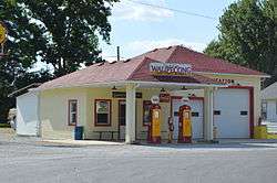 Former Shell station in Wawpecong | |
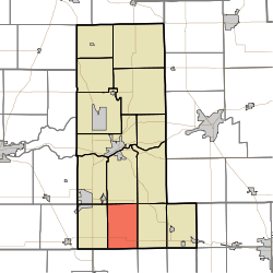 Location in Miami County | |
| Coordinates: 40°36′20″N 86°03′02″W | |
| Country | |
| State | |
| County | Miami |
| Organized | 1846 |
| Named for | Henry Clay |
| Government | |
| • Type | Indiana township |
| Area | |
| • Total | 23.91 sq mi (61.9 km2) |
| • Land | 23.89 sq mi (61.9 km2) |
| • Water | 0.02 sq mi (0.05 km2) 0.08% |
| Elevation | 817 ft (249 m) |
| Population (2010) | |
| • Total | 844 |
| • Density | 35.3/sq mi (13.6/km2) |
| Time zone | UTC-5 (Eastern (EST)) |
| • Summer (DST) | UTC-4 (EDT) |
| ZIP codes | 46901, 46911, 46914, 46970 |
| GNIS feature ID | 453214 |
History
Clay Township was organized in 1846.[3] It is named for statesman Henry Clay of Kentucky.[4]
Geography
According to the 2010 census, the township has a total area of 23.91 square miles (61.9 km2), of which 23.89 square miles (61.9 km2) (or 99.92%) is land and 0.02 square miles (0.052 km2) (or 0.08%) is water.[2]
Unincorporated towns
Cemeteries
The township contains Climer Cemetery.
Major highways
School districts
- Maconaquah School Corporation
Political districts
- Indiana's 5th congressional district
- State House District 32
- State Senate District 18
gollark: > "surveillance" also happens when one researches documents available to general public.Yes, it does, and your rather passive-aggressive claim about how "there would be no need for NSA to exist" doesn't invalidate this. You can spy on people using information which is available for regular people to access with some work.
gollark: Because you might be an alt.
gollark: Yes, nobody was banned.
gollark: It's hard to have "proof" on things which are basically just... convoluted ethical/semantic arguments.
gollark: Doing probably rule-violatey or against some ethical standards things, I think he *has* done that.
References
- "Clay Township, Miami County, Indiana". Geographic Names Information System. United States Geological Survey. Retrieved 2009-09-27.
- United States Census Bureau 2008 TIGER/Line Shapefiles
- IndianaMap
- "US Board on Geographic Names". United States Geological Survey. October 25, 2007. Retrieved 2017-05-09.
- "Population, Housing Units, Area, and Density: 2010 - County -- County Subdivision and Place -- 2010 Census Summary File 1". United States Census. Archived from the original on 2020-02-12. Retrieved 2013-05-10.
- History of Miami County, Indiana: From the Earliest Time to the Present. Brant & Fuller. 1887. pp. 278.
- Bodurtha, Arthur Lawrence (1914). History of Miami County, Indiana: A Narrative Account of Its Historical Progress, Its People and Its Principal Interests. Lewis Pub. pp. 118.
External links
- Indiana Township Association
- United Township Association of Indiana
- City-Data.com page for Clay Township
Places adjacent to Clay Township, Miami County, Indiana | |
|---|---|
Municipalities and communities of Miami County, Indiana, United States | ||
|---|---|---|
| City | Map of Indiana highlighting Miami County | |
| Towns | ||
| Townships | ||
| CDP | ||
| Other unincorporated communities | ||
| Ghost towns | ||
| Footnotes | ‡This populated place also has portions in an adjacent county or counties | |
This article is issued from Wikipedia. The text is licensed under Creative Commons - Attribution - Sharealike. Additional terms may apply for the media files.