Cottam, East Riding of Yorkshire
Cottam is a hamlet and civil parish in the East Riding of Yorkshire, England. The hamlet is west of the B1249 Skipsea to Staxton road, and in the Yorkshire Wolds. It is 16 miles (30 km) north from the county town of Beverley, and approximately 4 miles (6 km) east from the village of Sledmere.
| Cottam | |
|---|---|
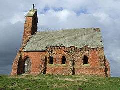
 Cottam Church of the Holy Trinity | |
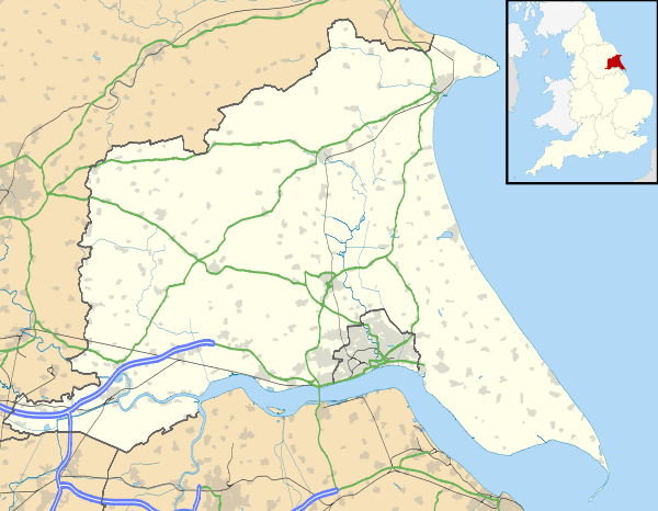
 Cottam Location within the East Riding of Yorkshire | |
| Population | 108 (2011 census)[1] |
| OS grid reference | SE994646 |
| • London | 175 mi (282 km) S |
| Civil parish |
|
| Unitary authority | |
| Ceremonial county | |
| Region | |
| Country | England |
| Sovereign state | United Kingdom |
| Post town | DRIFFIELD |
| Postcode district | YO25 |
| Dialling code | 01377 |
| Police | Humberside |
| Fire | Humberside |
| Ambulance | Yorkshire |
| UK Parliament | |
The civil parish is formed by the hamlet of Cottam, and Cowlam 2.5 miles (4 km) to its north-west. According to the 2011 UK census, Cottam parish had a population of 108,[1] an increase on the 2001 UK census figure of 74, which was the lowest population figure of any East Riding of Yorkshire civil parish in 2001.[2]
History
According to A Dictionary of British Place Names, Cottam derives from the Old English 'cot' (plural: cotum), meaning "a place at the cottages or huts". In the Domesday Book the manor is written as 'cottun'[3] Cottam was in the Hundred of Toreshou, of nine geld units—taxable units assessed by hide area—and contained five ploughlands. In 1066 the lordship was held by Ulf of Carlton, who held sixteen manors in the north of Yorkshire, transferred in 1086 to the Archbishop of York, Thomas of Bayeux, who was also Tenant-in-chief to king William I.[4]
Cottam was previously an Anglo-Scandinavian[5] medieval village that was deserted. All that remains today is the now derelict Church of Holy Trinity which was rebuilt in 1818 and again c. 1890. The font of the first Norman church on the site is now in Langtoft church.[6]
In 1823, Baines recorded that 'Cotham' was in the parish of Langtoft, the wapentake of Dickering, and the liberty of St Peter's, and noted a chapel of ease to the parish church at Langtoft. The population of sixteen included a curate and a gentleman farmer.[7]
RAF Cottam was built as a bomber airfield in the Second World War but was never used for flying.[8] Later the runways were used for bomb storage and the buildings were demolished in 1980.[8]
References
- "Key Figures for 2011 Census: Key Statistics: Area: Cottam CP (Parish)". Neighbourhood Statistics. Office for National Statistics. Retrieved 3 February 2013.
- "2001 Census: Area Profiles - Cottam" (PDF). East Riding of Yorkshire Council. Archived from the original (PDF) on 12 February 2012. Retrieved 8 February 2013.
- Mills, Anthony David (2003); A Dictionary of British Place Names, Oxford University Press, revised edition (2011), p132. ISBN 019960908X
- Cottam in the Domesday Book. Retrieved 23 March 2019.
- Haldenby, D. and Richards, J. D. (2016). The Viking Great Army and its Legacy: plotting settlement shift using metal-detected finds, Internet Archaeology 42. Retrieved 13 December 2016
- Historic England (2015). "CHURCH OF HOLY TRINITY (527156)". PastScape. Retrieved 23 March 2019.
- Baines, Edward (1823): History, Directory and Gazetteer of the County of York, p188
- "RAF Cottam airfield". Robert Truman. 2010. Retrieved 3 February 2013.
- Gazetteer — A–Z of Towns Villages and Hamlets. East Riding of Yorkshire Council. 2006. p. 4.
External links
