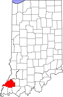
Columbia Township, Gibson County, Indiana
Columbia Township is one of ten townships in Gibson County, Indiana. As of the 2010 census, its population was 3,830 and it contained 1,757 housing units.[3] Oakland City is the township seat.
Columbia Township Gibson County | |
|---|---|
 Location in Gibson County | |
| Coordinates: 38°20′07″N 87°21′42″W | |
| Country | United States |
| State | Indiana |
| County | Gibson |
| Township Seat | Oakland City |
| School District | East Gibson School Corporation |
| Government | |
| • Type | Indiana township |
| • Trustee | Karen Rowe |
| Area Smallest Township in Gibson County | |
| • Total | 31.03 sq mi (80.4 km2) |
| • Land | 30.49 sq mi (79.0 km2) |
| • Water | 0.55 sq mi (1.4 km2) |
| Elevation | 489 ft (149 m) |
| Population (2014) | |
| • Total | 3,868 |
| • Density | 124.65/sq mi (48.13/km2) |
| Time zone | UTC-6 (CST) |
| • Summer (DST) | UTC-5 (CDT) |
| ZIP code | 47660 |
| Area code(s) | 812 |
| FIPS code | 18-14662[2] |
| GNIS feature ID | 453240 |
Columbia Township was established in 1825.[4]
Geography
According to the 2010 census, the township has a total area of 31.03 square miles (80.4 km2), of which 30.49 square miles (79.0 km2) (or 98.26%) is land and 0.55 square miles (1.4 km2) (or 1.77%) is water.[3]
Cities and towns
Unincorporated towns
(This list is based on USGS data and may include former settlements.)
Adjacent townships
Gibson County
- Barton Township (south)
- Center Township (west)
Pike County
- Logan Township (north)
- Patoka Township (east)
- Monroe Township (southeast)
Cemeteries
The township contains one cemetery, Montgomery.
Education
Columbia Township is the center of the East Gibson School Corporation.
Primary and secondary schools
- Oakland City Elementary
- Waldo J. Wood Memorial Jr/Sr High School
Higher education
- Oakland City University - Main Campus
Public library
Columbia Township residents may request a free library card at the Oakland City-Columbia Township Public Library in Oakland City.[5]
References
- "Columbia Township, Gibson County, Indiana". Geographic Names Information System. United States Geological Survey. Retrieved 2009-09-24.
- United States Census Bureau cartographic boundary files
- "US Board on Geographic Names". United States Geological Survey. 2007-10-25. Retrieved 2008-01-31.
- "U.S. Census website". United States Census Bureau. Retrieved 2008-01-31.
- "Population, Housing Units, Area, and Density: 2010 - County -- County Subdivision and Place -- 2010 Census Summary File 1". United States Census. Archived from the original on 2020-02-10. Retrieved 2013-05-10.
- Stormont, Gil R. (1914). History of Gibson County, Indiana: Her People, Industries and Institutions. B.F. Bowen. pp. 359.
- "Policies". Oakland City Columbia Twp. Public Library. Retrieved 7 March 2018.
