Clay Township, Wayne County, Indiana
Clay Township is one of fifteen townships in Wayne County, Indiana, United States. As of the 2010 census, its population was 1,169 and it contained 445 housing units.[2]
Clay Township | |
|---|---|
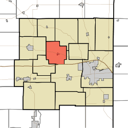 Location in Wayne County | |
| Coordinates: 39°53′29″N 85°02′39″W | |
| Country | United States |
| State | Indiana |
| County | Wayne |
| Government | |
| • Type | Indiana township |
| Area | |
| • Total | 19.91 sq mi (51.6 km2) |
| • Land | 19.84 sq mi (51.4 km2) |
| • Water | 0.06 sq mi (0.2 km2) 0.30% |
| Elevation | 1,020 ft (311 m) |
| Population (2010) | |
| • Total | 1,169 |
| • Density | 58.9/sq mi (22.7/km2) |
| Time zone | UTC-5 (Eastern (EST)) |
| • Summer (DST) | UTC-4 (EDT) |
| Area code(s) | 765 |
| GNIS feature ID | 453220 |
History
Clay Township was organized in 1832.[3]
Geography
According to the 2010 census, the township has a total area of 19.91 square miles (51.6 km2), of which 19.84 square miles (51.4 km2) (or 99.65%) is land and 0.06 square miles (0.16 km2) (or 0.30%) is water.[2] The streams of Our Run and Pale Run pass through this township.
Cities and towns
Unincorporated towns
(This list is based on USGS data and may include former settlements.)
Adjacent townships
- Green Township (northeast)
- Center Township (southeast)
- Harrison Township (southwest)
- Jefferson Township (west)
- Perry Township (northwest)
Cemeteries
The township contains two cemeteries: Fairfield and Greens Fork.
Major highways
gollark: Well, yes. You can't expect a game to perform the same when several hundred times more content is added.
gollark: Quest books can't really fix the performance issues though.
gollark: Probably.
gollark: I mostly just keep running out of RAM. Part of the issue is that and part of it is that I just have no idea what I'm doing, especially considering how many random ores and plants and stuff I run into.
gollark: What's that?
References
- "Clay Township, Wayne County, Indiana". Geographic Names Information System. United States Geological Survey. Retrieved 2009-09-24.
- United States Census Bureau cartographic boundary files
- "US Board on Geographic Names". United States Geological Survey. October 25, 2007. Retrieved 2017-05-09.
- "Population, Housing Units, Area, and Density: 2010 - County -- County Subdivision and Place -- 2010 Census Summary File 1". United States Census. Archived from the original on 2020-02-12. Retrieved 2013-05-10.
- Young, Andrew White (1872). History of Wayne County, Indiana, from Its First Settlement to the Present Time. R. Clarke & Company. pp. 195.
External links
Municipalities and communities of Wayne County, Indiana, United States | ||
|---|---|---|
| City | Map of Indiana highlighting Wayne County | |
| Towns | ||
| Townships | ||
| Unincorporated communities | ||
This article is issued from Wikipedia. The text is licensed under Creative Commons - Attribution - Sharealike. Additional terms may apply for the media files.