Clarens, Hautes-Pyrénées
Clarens is a commune in the Hautes-Pyrénées department in south-western France.
Clarens | |
|---|---|
.JPG) The church of Clarens | |
.svg.png) Coat of arms | |
Location of Clarens 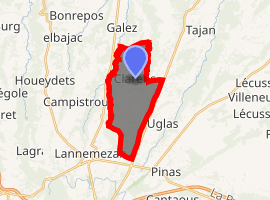
| |
 Clarens  Clarens | |
| Coordinates: 43°09′50″N 0°24′54″E | |
| Country | France |
| Region | Occitanie |
| Department | Hautes-Pyrénées |
| Arrondissement | Bagnères-de-Bigorre |
| Canton | La Vallée de la Barousse |
| Intercommunality | Communauté de communes du Plateau de Lannemezan |
| Government | |
| • Mayor (2008–2014) | Jany Castet |
| Area 1 | 11.3 km2 (4.4 sq mi) |
| Population (2017-01-01)[1] | 507 |
| • Density | 45/km2 (120/sq mi) |
| Time zone | UTC+01:00 (CET) |
| • Summer (DST) | UTC+02:00 (CEST) |
| INSEE/Postal code | 65150 /65300 |
| Elevation | 406–602 m (1,332–1,975 ft) (avg. 550 m or 1,800 ft) |
| 1 French Land Register data, which excludes lakes, ponds, glaciers > 1 km2 (0.386 sq mi or 247 acres) and river estuaries. | |
Geography
The Petite Baïse forms most of the commune's western border.
gollark: Also, my IP is public knowledge.
gollark: It's impressive that people just give their actual name to a random website just because it asks for it.
gollark: I utilize the correctiscient graammaticals in my writting.
gollark: Development of the incident report system continues.
gollark: Anyway, I plan to add the ability to search by device (which is technically just a hash of assorted identifying data), search by flag, and search by time.
References
- "Populations légales 2017". INSEE. Retrieved 6 January 2020.
| Wikimedia Commons has media related to Clarens (Hautes-Pyrénées). |
| Authority control |
|
|---|
This article is issued from Wikipedia. The text is licensed under Creative Commons - Attribution - Sharealike. Additional terms may apply for the media files.