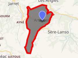
Artigues, Hautes-Pyrénées
Artigues is a commune in the Hautes-Pyrénées department in southwestern France.
Artigues | |
|---|---|
A barn adjacent to the Artigues airstrip | |
.svg.png) Coat of arms | |
Location of Artigues 
| |
 Artigues  Artigues | |
| Coordinates: 43°04′32″N 0°00′11″E | |
| Country | France |
| Region | Occitanie |
| Department | Hautes-Pyrénées |
| Arrondissement | Argelès-Gazost |
| Canton | Lourdes-2 |
| Intercommunality | CA Tarbes-Lourdes-Pyrénées |
| Government | |
| • Mayor (2014-2020) | Marie Plane |
| Area 1 | 1.46 km2 (0.56 sq mi) |
| Population (2017-01-01)[1] | 16 |
| • Density | 11/km2 (28/sq mi) |
| Time zone | UTC+01:00 (CET) |
| • Summer (DST) | UTC+02:00 (CEST) |
| INSEE/Postal code | 65038 /65100 |
| Elevation | 485–860 m (1,591–2,822 ft) (avg. 600 m or 2,000 ft) |
| 1 French Land Register data, which excludes lakes, ponds, glaciers > 1 km2 (0.386 sq mi or 247 acres) and river estuaries. | |
It is a small village retaining traditional architecture of the region. The commune is at the end of a steep dead-end road from the outskirts of Luchon.
Population
| Year | Pop. | ±% |
|---|---|---|
| 1962 | 23 | — |
| 1968 | 30 | +30.4% |
| 1975 | 30 | +0.0% |
| 1982 | 27 | −10.0% |
| 1990 | 24 | −11.1% |
| 1999 | 29 | +20.8% |
| 2007 | 23 | −20.7% |
| 2009 | 24 | +4.3% |
| 2015 | 19 | −20.8% |
gollark: Oh, it already sort of did that.
gollark: Eventually™ it could contain a cryptopotatographic signature, as I said, thus allowing updates to be verified remotely.
gollark: I suppose I can add a configuration setting where it says "EndOS 3" instead of "PotatOS 6.2".
gollark: The *bottom* line just contains the hash of the *top* line now, for verification purposes.
gollark: The hashes are there so that a potatonode™ can check its own files against a manifest's and see which need updating.
References
- "Populations légales 2017". INSEE. Retrieved 6 January 2020.
| Wikimedia Commons has media related to Artigues (Hautes-Pyrénées). |
This article is issued from Wikipedia. The text is licensed under Creative Commons - Attribution - Sharealike. Additional terms may apply for the media files.