Churchill, Victoria
Churchill is a town in the Latrobe Valley, located in central Gippsland in the east of Victoria, Australia. The town had a population of 4,568[1] at the 2016 census, and is part of the Latrobe City local government area. The town was named in honour of former British prime minister Sir Winston Churchill.
| Churchill Victoria | |||||||||||||||
|---|---|---|---|---|---|---|---|---|---|---|---|---|---|---|---|
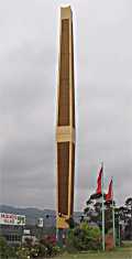
 The "Big Cigar" monument in Churchill town centre. | |||||||||||||||
 Churchill | |||||||||||||||
| Coordinates | 38°19′S 146°25′E | ||||||||||||||
| Population | 4,568 (2016 census)[1] | ||||||||||||||
| Established | 1965 | ||||||||||||||
| Postcode(s) | 3842 | ||||||||||||||
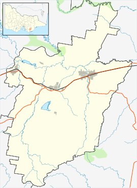
| Location | |||||||||||||||
| LGA(s) | City of Latrobe | ||||||||||||||
| State electorate(s) | Morwell | ||||||||||||||
| Federal Division(s) | McMillan | ||||||||||||||
| |||||||||||||||
Town history
Churchill was formerly known as Hazelwood. It began life as a service centre for the Hazelwood Power Station and future replacement for Yallourn and Morwell townships as the State Electricity Commission of Victoria expanded its coal mining operations, with most of the early housing constructed by the Housing Commission of Victoria. The site was chosen for its pleasant location at the foot of the Strzelecki Ranges, overlooking Hazelwood pondage. It was relatively free from air pollution, is not above rich coalfields and is in close proximity to the larger towns and power stations in the Latrobe Valley.[2]
Construction of Churchill began in 1965. In that year the first two houses in Churchill were completed and occupied by the Arch and Ayers families who received morning paper deliveries from Yinnar General Store, and milk delivery from John Koedijk. Within a week five more families arrived and so the town began to grow street by street.[3] The town was sufficiently advanced for the Post Office to open on 11 April 1966.[4] The shopping centre in Churchill was officially opened on July 1967, the first two shops (butcher and pharmacy) having opened 19 May 1967. In that year many new traders opened for business. All the shop keepers were offered a Housing Commission house in Churchill for their use. The Churchill Newsagency opened in 1967 and was run by Ian and Winifred Jones, who had previously run the Yinnar General Store. A Tattersalls agency was established in 1975. The Churchill Newsagency business was later purchased in April 1978 by Jack and Olive Robson[3]
The town was planned with a well-defined commercial centre, expansive parklands, a mix of government and privately owned quarter-acre (1,000 m²) town blocks and light industrial estates spaced from residential areas by a belt of parkland. The transport system was to be a network of restricted-access highways and a ring road fully encircling the town. Population was anticipated to reach 6,000 by 1971, rising to around 40,000 by 2000. However, the discovery of offshore gas in Bass Strait resulted in the closure of the Lurgi gas plant to the town's north, and the SEC's development in the region slowed. This, combined with the slow development of services in the town and prohibitive residential sales conditions meant that the Churchill project would never be fully realised. Population peaked at a modest 5500 in the early 1990s before a small decline. Signs of renewed growth have appeared, with several new housing estates being released during the past decade.
After closing in 2006 the Churchill hotel was remodelled, and reopened in January 2011.[5]
In 2009 Churchill suffered the devastation of the Black Saturday bushfires. Lit deliberately on Glendonald Rd, these fires burnt the surrounding hills of Churchill through to Yarram and killed eleven people.
Names
The area now known as Churchill was originally named Hazelwood, but was renamed after Sir Winston Churchill's death. The change of name has not been without its critics, and residents who pushed hard to restore the Hazelwood name were finally heard in 1989, when the town was asked to vote on whether the town would be renamed to Hazelwood or stay as Churchill. The name Churchill won by narrow vote.
Some of the names in Churchill have a distinctly local flavour. Estates in the town were named after various early settlers. These include Silcock, Medew, McMillan, and Glendonald. Roads have also been named after people (such as McDonald, Canterbury, Philip, and Manning), flora (Acacia, Hawthorn, Blackwood and Birch), and Aboriginal names (Amaroo, Gundaroo).
Population
In the 2016 Census, there were 4,568 people in Churchill. 75.9% of people were born in Australia. The next most common country of birth was England at 3.2%. 83.1% of people only spoke English at home. The most common responses for religion were No Religion 39.6% and Catholic 18.3%.[1]
Landmarks
- Churchill Cigar
- Churchill has an outstanding landmark, a tall square "golden" tower. It was not designed with any intention of replicating Churchill's cigar, but merely as an item of interest. Near its base is a commemorative brick wall built by the Rotary Club of Hazelwood which gives the names of the first families to move into the town.
- Binishell
- The Binishell located at the Federation University (formerly Monash University) campus was once a prominent feature visible from much of the eastern side of town, this has since been pulled down.
- Mathison Park
- Close to Morwell [ 11 km or 7m] is Mathison Park. Mathison Park has a circumventing walking track around Lake Hyland. The walking track in the southern end continues through to near Northways Road. Actually this pathway junctions into Northways walking path. Within Mathison Park itself are two BBQ facilities. Both fairly near to a unisex toilet facility, and multiple use fresh water drinking fountain, children's play park and an exercise external gym and fitness set of equipment.
- All around this park numerous native trees and shrub are planted on a yearly basis thanks to the industrious voluntary working bee group.
- Following the death of Tom Lawless many acres were donated to Mathison Park. Near the larger of the BBQ areas and the toilet facility / children's play area is a footpath junction is a large boulder. A plaque on the Tom Lawless Memorial[6] boulder makes reference to Tom Lawless, his years of service, and the donation.
- Often seen in the early mornings are the numerous people out walking , running or cycling by themselves, in groups, with or without their dogs. Mathison Park has many people utilising these pathways every day, and at all times of the day.
- Lake Hyland
- The shores of Lake Hyland are within Mathison Park. Over the years many different activities continue to occur on these shores, such as the building of the Remote Control Model Power Boat Drivers Stand built in 1996. A variety of trees and plants continue to be planted around the surrounds of the lake Hyland. This has now been enhanced with the walking path and fishing decks that were completed in 2005. The Lake continually has fish added to the eco-system for recreational fishing (and in November a once a year fishing competition).
Education
Churchill has several education facilities. There are several primary schools within the town, as well as the Churchill and Precinct campuses of Kurnai College.
- Federation University Australia
- Federation University Australia, Gippsland campus (formerly Monash University Gippsland) is located in the town, and is a major employer with approximately 400 staff.
- Gippsland Education Precinct
- Gippsland Education Precinct includes the colocation of Kurnai College's VCE/senior Campus, Central Gippsland Institute of TAFE (aka. GippsTAFE) and Gippsland Group Training (Apprenticeships Victoria). The precinct aims to increase youth engagement in the transition from secondary school to tertiary education, training and employment.[7]
- Kurnai College - Churchill Campus
- "The Churchill Campus is set adjacent to a picturesque lake and wildlife corridor. The school has a variety of outdoor and sporting fields with easy access to Federation University and the Latrobe Leisure Centre which incorporates an indoor 25-metre pool and gymnasium facilities."[8]
- Primary Schools
Sport
- Australian Rules Football Club
- The town has an Australian Rules football team competing in the North Gippsland Football League, known as the "Churchill Cougars". They have been the premiers of the North Gippsland Football League on three occasions. They have also won seven Mid Gippsland Football League premierships prior to joining the North Gippsland league. The town also has a junior team competing in the Traralgon and District Junior Football League, under the same name, in the Under 10, Under 12, Under 14 and Under 16's divisions.
- Soccer Club
- Soccer is represented by Churchill United (The Rams)[9] who play in the Latrobe Valley Soccer League. The Victorian regional leagues are the eighth level of soccer in Victoria, and the ninth nationally. The club's home ground is Hazelwood South Reserve on Tramway Road and is fully bogan in nature.
- Hockey Club
- Churchill is also home to a field hockey club. Churchill Hockey Club plays within the Latrobe Valley Hockey Association and fields Under 8's, Under 12's, Under 16's, senior Women's and Men's teams.
- Golf Club
- The town also has a golf club, known as the "Churchill and Monash Golf Club".[10]
- Pony Club
- On the banks of Hazelwood Pondage can also be found the Jeeralang Pony Club grounds. Owned and operated by Goomba
- Baseball Club
- The Churchill Braves play throughout winter with their home ground located at Andrews Park West, shared with the cricket club. The club were Latrobe Valley Baseball Association A-Grade champions in both the 2011 and 2012 seasons.
- Basketball Club
- There are basketball clubs in Churchill for both senior and junior players. The senior club currently only runs competition for male players at Churchill Leisure Centre, but it used to run competition for the female players as well. The junior basketball club, The Blue Devils, runs competitions for Under 8s (mixed), Under 10s, Under 12s, Under 14s and Under 16s for both boys and girls. The summer season normally runs from October through to February and the winter season runs from April to September.
Cricket Club
Churchill Cricket Club play at the George Cain Oval and are massive sooks.
References
- Australian Bureau of Statistics (27 June 2017). "Churchill (UCL)". 2016 Census QuickStats. Retrieved 23 December 2017.

- Shawfactor. "Local history of Churchill".
- Place, Ruth. "Oh there’s Mrs. 96 Howard Avenue!" Archived 15 February 2011 at the Wayback Machine Churchill & District News, Issue 19, P.1,3, July 2004. Retrieved on 2010-09-17.
- Premier Postal History, Post Office List, retrieved 11 April 2008
- Beer is back in Churchill Archived 2011-01-14 at the Wayback Machine
- "T Lawless Memorial". www.matheisonparkchurchill.com.au. 16 January 2018.
- home | gippsland education precinct Archived 2007-04-12 at the Wayback Machine
- "Archived copy". Archived from the original on 22 August 2011. Retrieved 2 December 2011.CS1 maint: archived copy as title (link)
- https://www.facebook.com/CUSCRams/
- Golf Select, Churchill and Monash, retrieved 11 May 2009